NASA scientists employed a pixel-tracking method to reveal how much the ground shifted during one of the largest documented surface ruptures of its type.

Fires in these coastal forests can rejuvenate ecosystems but also threaten large numbers of people and homes in the densely populated state.

The volcanic features and otherworldly landscape of Craters of the Moon National Monument and Preserve are apt training grounds for planetary exploration.
Published Apr 24, 2025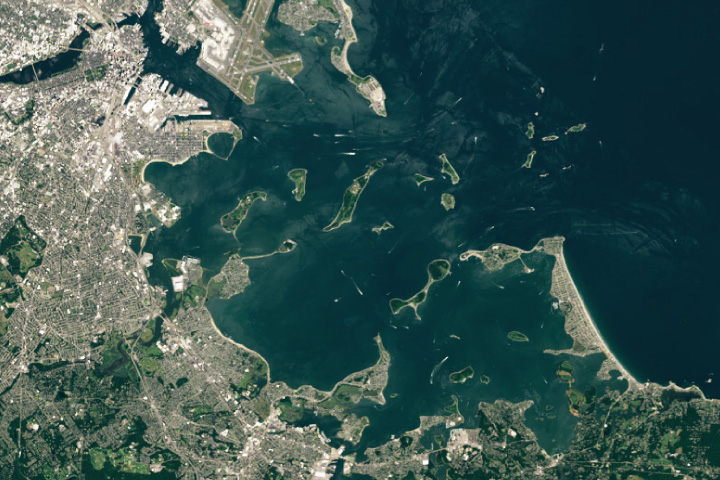
A national recreation area and state park protect an archipelago made of glacial debris in eastern Massachusetts.
Published Apr 23, 2025
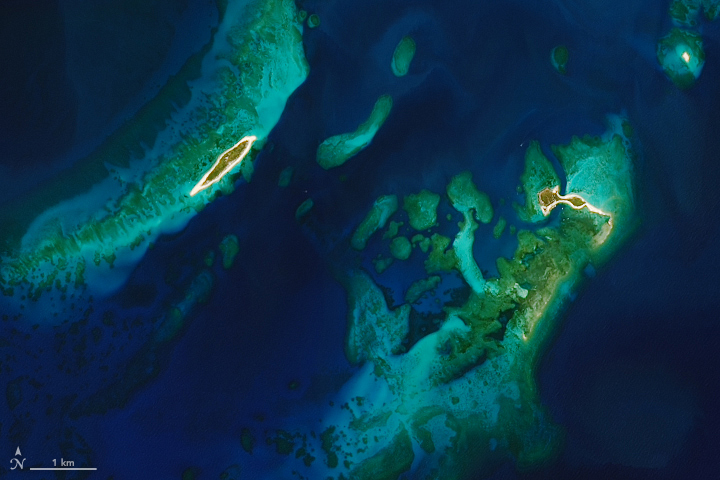
Your challenge is to use the comments section to tell us where it is, what we are looking at, and why it is interesting.
Published Apr 22, 2025
The peaks in Guadalupe Mountains National Park—some of the highest in Texas—are made of a well-preserved fossil reef formed more than 250 million years ago.
Published Apr 22, 2025
The Channel Islands off the coast of southern California support diverse ecosystems, with some plants and animals found nowhere else on the planet.
Published Apr 21, 2025
The large metropolis, fringed by scenic coastline, stretches across two continents.
Published Apr 20, 2025
Despite its stately and serene appearance, the Alaskan volcano has shown signs of activity since spring 2024.
Published Apr 19, 2025
A thick dust plume in the Middle East dimmed skies and sent thousands to the hospital in April 2025.
Published Apr 17, 2025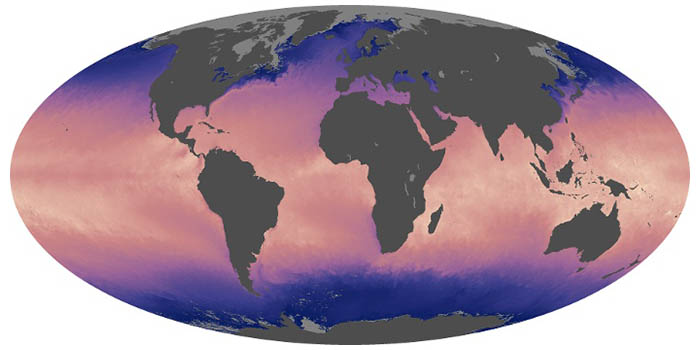
Ocean temperatures can influence weather, such as hurricane formation, and climate patterns, such as El Niño. These maps show the temperature at the surface of the world’s seas and oceans.

What do you do when presented with a new satellite image? Here's what the Earth Observatory team does to understand the view.
Published Nov 18, 2013
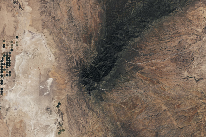
Folds of rusted rock neighbor the Bighorn Canyon’s deep scar in the western United States.
Published Apr 17, 2025
A major embayment in West Antarctica saw new sea ice growth in autumn 2025 amid older sea ice that had survived the austral summer melt season.
Published Apr 16, 2025
Satellite images of Earth at night have been a curiosity for the public and a tool of fundamental research for at least 25 years. They have provided a broad, beautiful picture, showing how humans have shaped the planet and lit up the darkness.
Published Apr 12, 2017
An astronaut orbiting over Southeast Asia captured a colorful photo of the lights from boats, ports, and other lit infrastructure.
Published Apr 13, 2025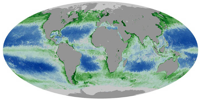
Chlorophyll is used by algae and other phytoplankton--the grass of the sea--to convert sunlight and carbon dioxide into sugars. These maps show chlorophyll concentrations in the ocean, revealing where phytoplankton are thriving.
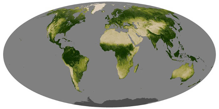
Greenness is an important indicator of health for forests, grasslands, and farms. The greenness of a landscape, or vegetation index, depends on the number and type of plants, how leafy they are, and how healthy they are.

One of the largest islands in the Mediterranean, this region of Italy has developed a cultural and natural heritage all its own over the millennia.
Published Apr 12, 2025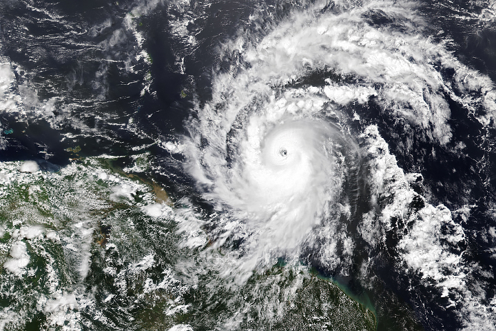
Hurricane season in the basin runs from June 1 to November 30.
Published Jul 1, 2024
NASA satellites document how our world—forests, oceans, human landscapes, even the Sun—changes over months, seasons, and years.
Published Apr 29, 2009Have you ever wondered what it would be like to live in a different part of the world? What would the weather be like? What kinds of animals would you see? Which plants live there? By investigating these questions, you are learning about biomes.
Published Aug 28, 2020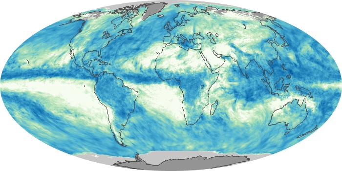
These maps depict monthly total rainfall around the world. Rainfall is the primary source of fresh water for humans, plants, and animals. Rain also moves heat between the atmosphere, oceans, and land.
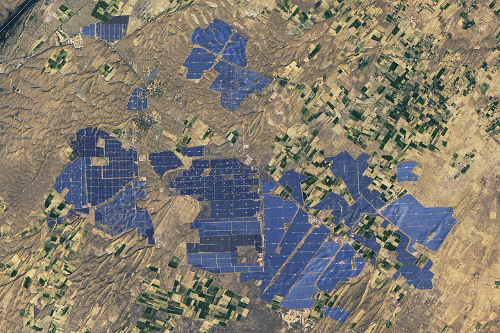
People have developed systems to harvest and store energy from sources such as wind, sunlight, and tidal action. Many of these installations are visible from orbit.
Published May 10, 2024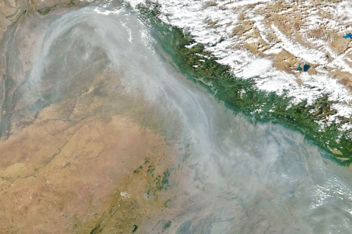
From ground-level ozone to particulate matter to nitrogen dioxide, an array of gasses and particles can affect the air people breathe, with implications for human health.
Published Apr 8, 2024
12 months of high-resolution global true color satellite imagery.
Published Oct 13, 2005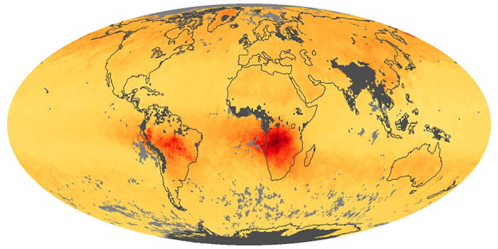
When fuels such as coal, wood, and oil burn incompletely, they produce carbon monoxide. The gas is spread by winds and circulation. These maps show monthly averages of CO in the lower atmosphere.
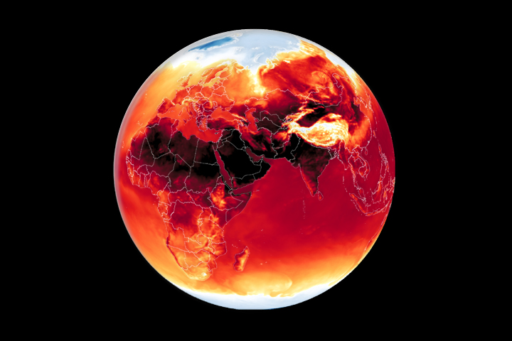
Warmer-than-average temperatures are showing up locally and globally, with consequences for people, landscapes, and ecosystems.
Published Mar 26, 2024
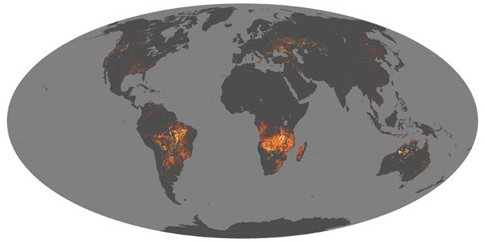
Whether sparked by lightning, intentional land-clearing, or human-caused accidents, wildland fires are burning longer and more often in some areas as the world warms.
Published Feb 27, 2024
Warmer-than-average temperatures are showing up locally and globally, with consequences for people, landscapes, and ecosystems.
Published Aug 15, 2023