During the Triassic Period, about 220 million years ago, the present-day continent of North America was part of the supercontinent Pangea. Commensurate with Pangea’s tremendous size, its weather patterns also achieved large scales. Scientists think the tropical zones of this giant landmass experienced “megamonsoons” in this period, setting up fluctuations between extreme wet and dry seasons.
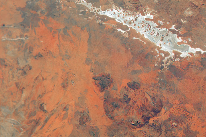
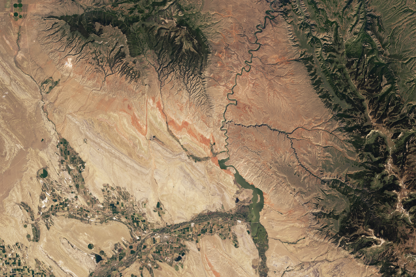
These cycles of wetting and drying are believed to have oxidized, or rusted, sediments across vast areas. The resulting rock layers, commonly referred to as “red beds,” take their color from the mineral hematite and now appear on several continents. In North America, the rusted Triassic rocks show up in a handful of places, including Bighorn Basin in northern Wyoming and southern Montana. This oval-shaped basin, approximately 150 miles (240 kilometers) long and 80 miles (130 kilometers) wide, is encircled by six mountain ranges and is rich in both fossils and oil and gas reservoirs.
Sharp folds of the distinct reddish Chugwater Formation cut across the image above, acquired with the OLI-2 (Operational Land Imager-2) on Landsat 9 in June 2024. In the tens of millions of years since the Chugwater’s Triassic conception, the Pangean supercontinent fragmented, and landmasses recombined. The sedimentary rock layers seen here were folded and tilted in the continental collisions that created the Rocky Mountains. These folds are located near the northern end of Bighorn Basin; other outcrops of the Chugwater appear in the basin, often along its perimeter.

The recreation area encompasses a wide range of natural and cultural wonders. Researchers have discovered fossils dating back to the Jurassic Period within its boundaries. Today, the shrubland, woodland, and steppe habitats are home to wildlife such as bighorn sheep, wild horses, and coyotes. Artifacts along parts of the Bad Pass Trail, traveled by Native Americans for thousands of years, are preserved within the park. Now, more than 200,000 people visit the area each year for hiking, boating, fishing, and other activities.
NASA Earth Observatory images by Wanmei Liang, using Landsat data from the U.S. Geological Survey. Story by Lindsey Doermann.