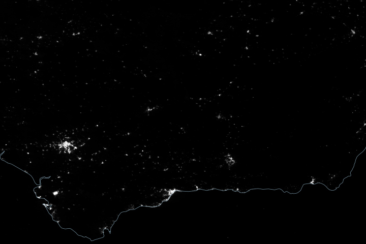
Satellite-derived maps of nighttime lights in southern Spain revealed power outages that persisted across rural areas as the region was recovering from a widespread blackout.
Published May 1, 2025
Detailed fire maps, produced in minutes with data from a NASA airborne sensor, enabled firefighters in Alabama to limit the spread of wildfires and save buildings.
Published Apr 29, 2025
Fires in these coastal forests can rejuvenate ecosystems but also threaten large numbers of people and homes in the densely populated state.
Published Apr 24, 2025
A slow-moving storm system dumped heavy rain across the Midwest and Southeast and fueled major floods along several of the river’s tributaries.
Published Apr 8, 2025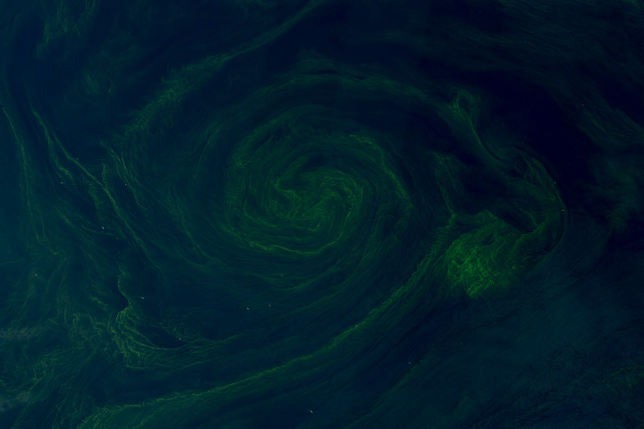
In the Gulf of Oman, eddies drew seasonal phytoplankton blooms into mesmerizing whirls.
Published Mar 25, 2025