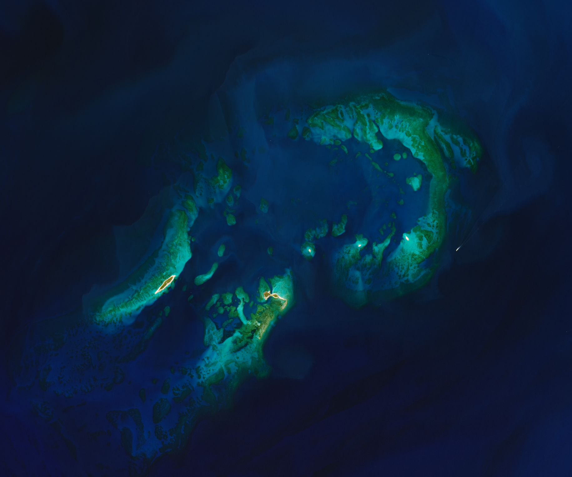
About 70 miles west of Key West, Florida, a handful of islands dot the blue-turquoise waters of the Gulf of America. Named for the islands’ lack of fresh water and abundant turtle populations, the park is primarily a seawater oasis.
These islands, the westernmost extent of the Florida Keys, are part of Dry Tortugas National Park. There are no resorts, bridges, or cars here; instead, visitors explore the area’s history and aquatic ecosystems on foot or by boat.
As national parks go, the land area is small, measuring just 144 acres (58 hectares). About 14 acres belong to Garden Key, the second largest of the park’s seven islands. It is also the island most affected by human activity. Its geometric shape stands out in this image of the park, acquired on March 20, 2025, by the OLI-2 (Operational Land Imager-2) on Landsat 9.
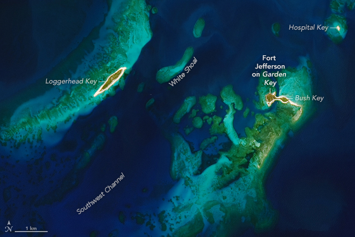
Garden Key’s amenities include the park’s headquarters as well as camping and snorkeling areas. One of the island’s main draws is Fort Jefferson, a massive 19th-century coastal fortress built to protect both the strategic deep-water anchorage in the Dry Tortugas and the gateway to the Gulf. Though never completed, the site is still the largest all-masonry fort in the United States. Hurricanes in 2017, 2022, and 2024 damaged the fort’s moat walls, which park officials say will be undergoing repairs until autumn 2026.
Storms, tides, currents, waves, and rising sea levels reshape both the engineered and natural areas of the Dry Tortugas islands, which are made up of carbonate sand and coral rubble. Garden Key and Bush Key, for example, are periodically connected by a land bridge or separated by a channel. In this scene, they appear to be joined by land.
Islands, however, account for less than one percent of the park. The remaining 99 percent is underwater. In this view, deeper waters around the islands are dark blue, while shallower waters along the coasts are light blue. The green areas in shallow water are likely coral reefs, though seagrass meadows can appear similar.
Pulaski Shoal, near the park’s northeast boundary, is a popular scuba diving destination, according to a park map. The area contains particularly shallow coral heads and is littered with the remains of several shipwrecks. Another popular dive site is on the park’s west side, where a massive mound of coral known as Texas Rock is home to a diverse range of coral species and plentiful sea life.
NASA Earth Observatory images by Lauren Dauphin, using Landsat data from the U.S. Geological Survey. Story by Kathryn Hansen.