On a clear, sunny day, Alaska’s Mount Spurr is visible from Anchorage, 78 miles (126 kilometers) to the east. It’s also this proximity to populated places that had nearby communities preparing for a potential influx of ash, as the volcano showed elevated signs of unrest in spring 2025, according to the Alaska Volcano Observatory (AVO).
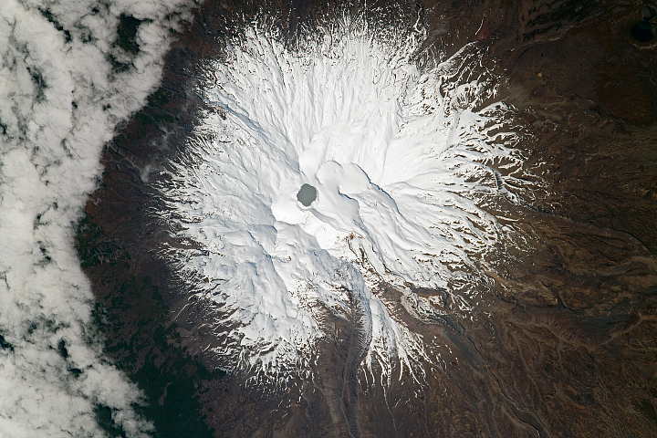
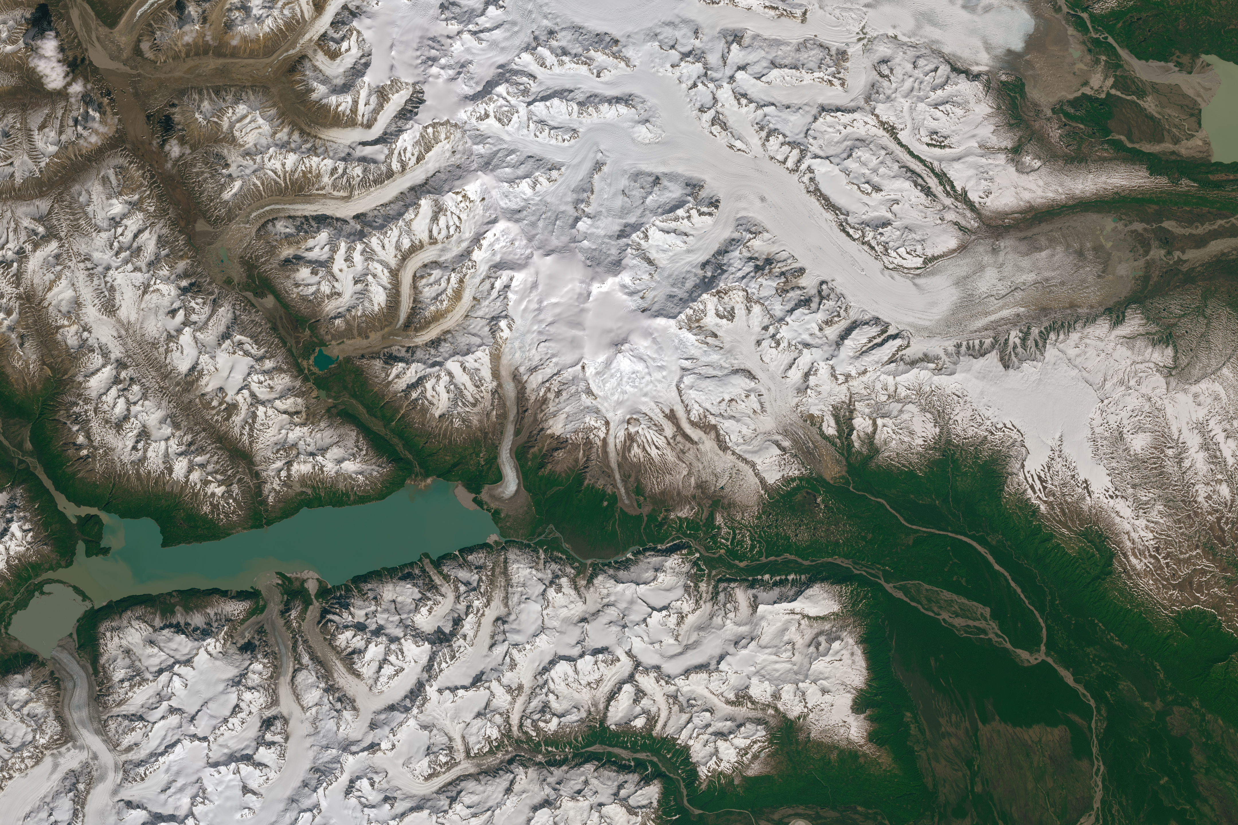
While officials routinely monitor Mount Spurr’s activity from the ground, sky, and space with an array of tools, it’s less common to see the volcano in natural-color satellite images due to the region’s persistent cloudiness. One of the clearest recent scenes acquired by the Landsat satellites dates back almost a year, as summer approached in 2024.
The OLI-2 (Operational Land Imager-2) on Landsat 9 captured these images on June 15, 2024. The picturesque scenes show the volcano’s snow-capped prominence and numerous glaciers punctuated by lush green valleys and fjords where lower-elevation seasonal snow and ice has melted away.

Mount Spurr lies on the northeastern side of the Aleutian Arc, which makes up a significant portion of the Ring of Fire. The 11,070-foot (3,374-meter) peak is located within the Tordrillo Mountains, west of Cook Inlet, and is bordered on the south by the Chakachatna River valley and the river’s headwaters, Ch’akajabena Lake.
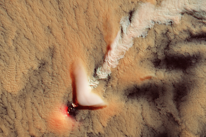
Though the volcano appears calm in these views, instruments had already been detecting increasing seismicity and ground deformation for several months in early 2024. Other indications of activity included a small lake that developed in Mount Spurr’s summit crater that spring and summer.
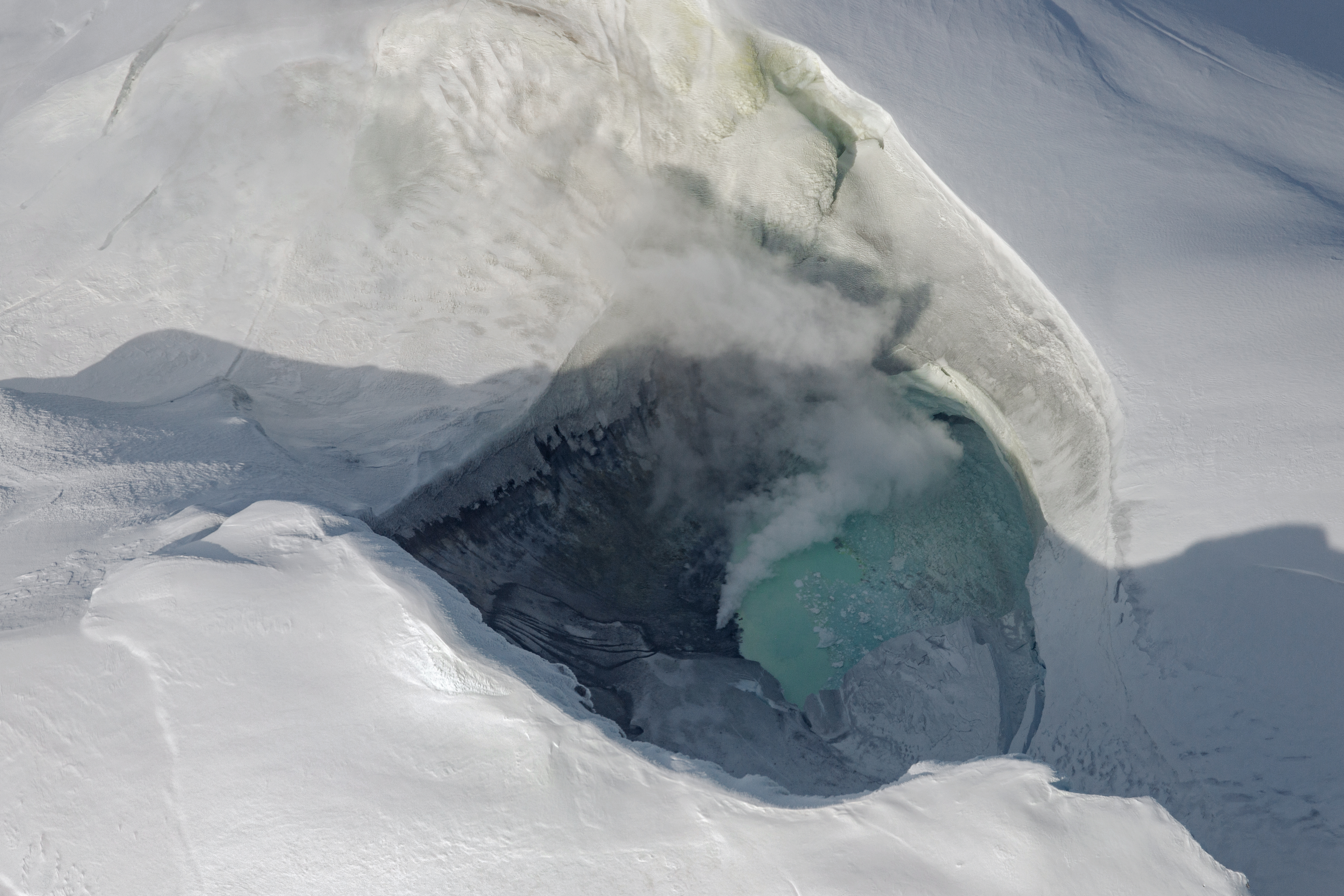
On June 23, 2024, AVO captured this photo (above) of the new lake on a flight over the crater. The lake was about the size of a football field, and steaming vents, or “fumaroles,” were visible along its shore. The last time a lake developed in the summit crater was during a previous period of unrest in 2004, which did not culminate in an eruption.
The only known past eruptions of modern-day Mount Spurr occurred in 1953 and 1992. Both of those events were associated with Crater Peak, a vent located about 2 miles (3 kilometers) south of Mount Spurr’s summit and visible in the detailed image at the top of this page.
The signs of volcanic unrest observed in spring and summer 2024 persisted above background levels, leading the AVO to raise the aviation color code to “yellow” and the volcano alert level to “advisory” in October of that year.
The alert levels remained in effect in 2025 as gas emissions, earthquakes, and ground deformation in March suggested that an eruption was likely. Several of these indicators lowered slightly in April, reducing the relative likelihood of an eruption. However, the AVO stated that an eruption similar to those of 1953 and 1992 was “still possible.”
NASA Earth Observatory images by Michala Garrison, using Landsat data from the U.S. Geological Survey. Photo by Rui Mota, courtesy of the Alaska Volcano Observatory. Story by Kathryn Hansen.