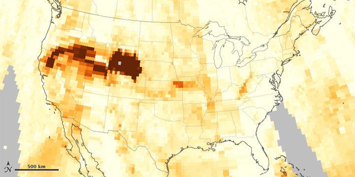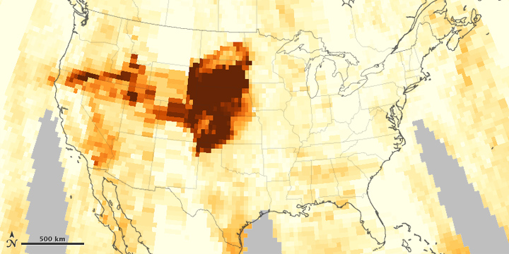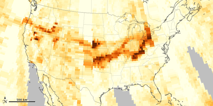


Intense wildfires in California and Idaho sent smoke eastward across the United States in mid-August 2012. Smoke affected air quality as far away as the Great Lakes Region, and some of the thickest smoke stretched from the Dakotas to Texas.
Wildfire smoke is a combination of gases and aerosols—tiny solid and liquid particles suspended in air—so remote-sensing instruments that detect aerosols can find smoke. The maps above are made from data collected by the Ozone Mapper Profiler Suite (OMPS) on the Suomi National Polar-orbiting Partnership (Suomi-NPP) satellite. They show relative aerosol concentrations over the continental United States, with lower concentrations appearing in yellow and higher concentrations appearing in dark orange-brown. Areas in gray represent data screened out due to sunglint (reflection of sunlight) or other factors.
On August 14, 2012, a band of dense aerosols stretched from the West Coast through Wyoming. The next day, thick aerosols collected over parts of North Dakota, Kansas, Oklahoma, and Texas. High concentrations almost completely shrouded South Dakota and Kansas. On August 16, aerosols formed a southward-dipping arc from the Pacific Northwest to the Great Lakes Region.
On August 16, 2012, the “Smog Blog” at the University of Maryland-Baltimore County reported that dense smoke stretched from the West Coast to the Great Lakes, and northward into Canada. Thinner smoke persisted across most of the United States. The Incident Information System reported that, as of August 17, some of the largest fires in the western states—Chips, Reading, Mustang Complex, Halstead, and Trinity Ridge—continued to burn, promising to send more thick smoke eastward across the country.
NASA image by Jesse Allen, using Suomi NPP OMPS data provided courtesy of Colin Seftor (SSAI). Suomi NPP is the result of a partnership between NASA, NOAA and the Department of Defense. Caption by Michon Scott.