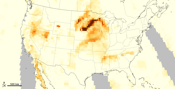


As Americans observed Independence Day, wildfires continued to burn across the western United States, including wildfires in Colorado and the Fontenelle Fire in Wyoming. Wildfire smoke affected large parts of the country, and aerosols were especially thick over the Midwest.
This color-coded map is made from data collected by the Ozone Mapper Profiler Suite (OMPS) on the Suomi National Polar-orbiting Partnership (S-NPP) satellite. It shows relative aerosol concentrations over the continental United States, with lower concentrations appearing in yellow, and greater concentrations appearing in dark orange-brown. Areas in gray represent data screened out due to sunglint (reflection of sunlight) or other factors.
High aerosol concentrations occurred west of the Great Lakes, particularly over South Dakota and Minnesota, but the Midwest was not the only part of the country to suffer from smoke. On July 4, 2012, the Smog Blog at the University of Maryland reported that air quality was unhealthy for sensitive groups throughout the Rocky Mountains. AIRNow warned that in areas where visibility dropped below 5 kilometers (3 miles), the air was probably unsafe for sensitive groups, including the elderly and people with breathing difficulties.
Smog Blog noted elevated aerosol levels in Oregon northward through Alberta, and suggested that smoke from Asia could be the cause.
NASA image by Jesse Allen, using OMPS data provided courtesy of Colin Seftor (SSAI). Caption by Michon Scott.