

high resolution images:
May 18, 2001 (330 KB)
June 19, 2001 (290 KB)
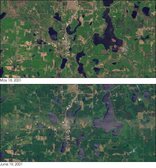
A destructive tornado hit the tiny town of Siren, Wisconsin (population 900), on the evening of June 18, 2001. Travelling from west to east, the twister killed three people, destroyed homes, uprooted trees, and flattened crops. The above true-color images show the effects of the tornado as seen from space. The top image, taken May 18, 2001, shows green crops as they would typically appear. The bottom image, taken the morning after the storm passed through, features a bright stripe directly through the center. This stripe is the result of the vegetation flattened by the storm. The flattened vegetation reflects more light than untouched vegetation. The images were taken by the Landsat 7 satellite's Enhanced Thematic Mapper plus instrument. The town of Siren is just to the left of center.
Images courtesy USGS EROS Data Center.