

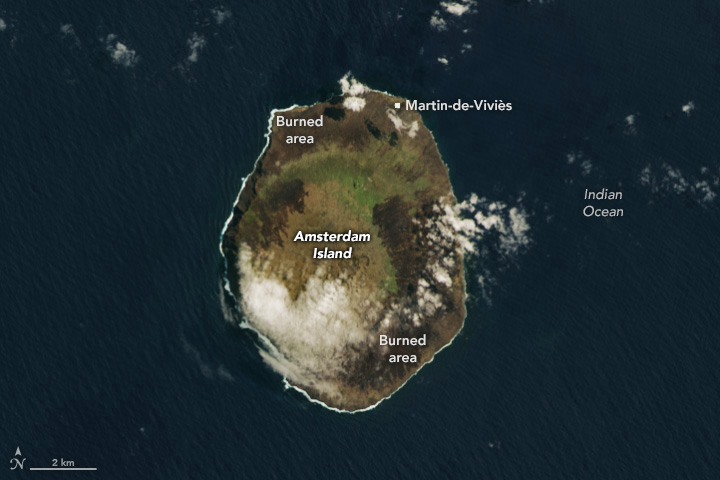

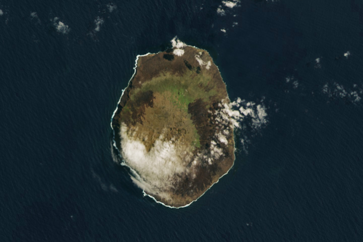
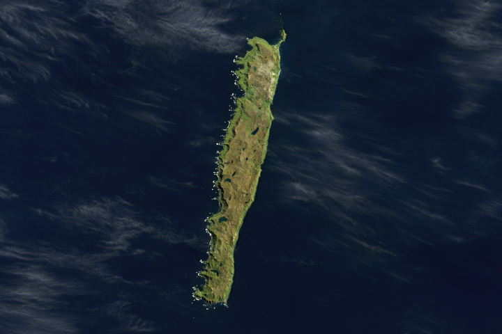
On the afternoon of January 15, 2025, a wildfire broke out on the northern end of Amsterdam Island. The island occupies a remote spot in the southern Indian Ocean between Australia, Antarctica, and Africa. Part of the French Southern and Antarctic Lands and a UNESCO World Heritage site, it is home to large marine mammal and bird populations, rare plant life, and a research station important for monitoring Earth’s atmosphere.
By February 9, when the OLI-2 (Operational Land Imager-2) on Landsat 9 acquired these images, the fire had burned a considerable portion of the 54-square-kilometer (21-square-mile) island. The image on the right is shown in false color to help distinguish between burned (brown) and healthy vegetation (green). The image on the left shows the same scene in natural color.
Burned areas form a thick ring around most of the island’s perimeter. Based on mapping by the Copernicus Emergency Management Service, the fire’s footprint spanned nearly 30 square kilometers—more than half of the island. The cause of the fire was unknown as of early February.
The fire started a few kilometers away from the Martin-de-Viviès research facility amid dry, windy conditions that helped it spread, according to a French Southern and Antarctic Lands (TAAF) news release. At daybreak the next morning, the 31 people stationed at Martin-de-Viviès evacuated safely to a nearby lobster fishing vessel. They were transferred to a TAAF ship a couple days later.
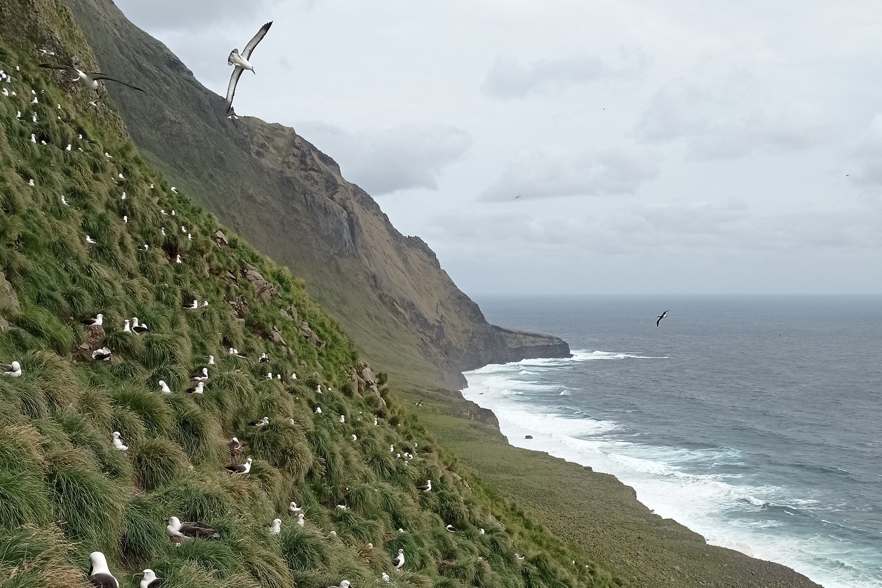
News reports have noted concern for the island’s distinct vegetation and abundant wildlife, although the fire’s effects on the ecosystem have yet to be assessed. Amsterdam Island is one of the few places in the world where the endangered Phylica arborea shrub grows. The speck of land also supports the world’s largest Atlantic yellow-nosed albatross population, the only Amsterdam albatross population, and colonies of elephant and fur seals.
Scientific research operations on Amsterdam are notable for including long-term monitoring of greenhouse gas concentrations in the atmosphere. These observations are made atop a cliff near the Martin-de-Viviès research station. Some of the power, water, and communications infrastructure at Martin-de-Viviès was damaged in the fire, according to a TAAF news release on January 29.
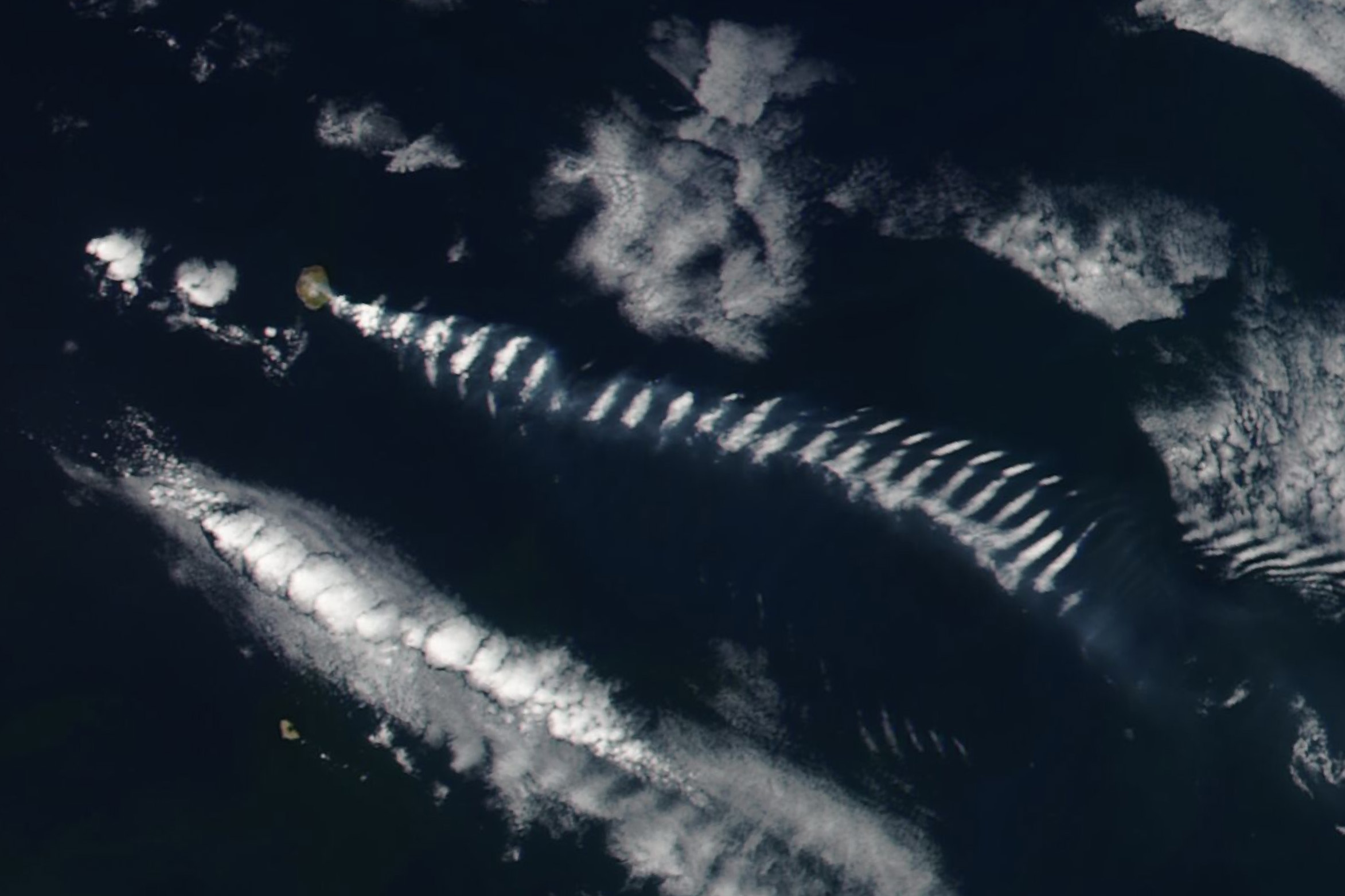
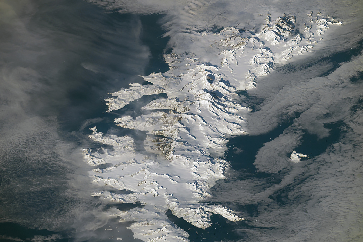
The island produced interesting atmospheric phenomena of its own as the fire burned. The VIIRS (Visible Infrared Imaging Radiometer Suite) on the Suomi NPP satellite captured this image of cloud bands and smoke downwind of the landmass on January 28.
“What you see at Amsterdam Island is a perfect example of a mountain wave effect,” said Galina Wind, atmospheric scientist at NASA’s Goddard Space Flight Center. This phenomenon occurs when winds blow through a stable atmosphere and encounter a barrier—in this case, Amsterdam Island jutting up 881 meters (2,890 feet) from the sea. The disturbance sets off vertical ripples in the air, where clouds form at the cooler wave crests and not in the warmer troughs.
A faint plume of wildfire smoke also trails to the lee side of the island, entrained with the eddies, Wind noted. If the smoke were brighter, she said, it might be visible forming a similar wave pattern.
“Because the air is otherwise very stable with very little convection,” Wind said, “this pattern is being transported wholesale by the general circulation far away from the island.” Mountain-wave clouds extended over 300 kilometers (200 miles) on this day—even beyond the scope of the image above.
NASA Earth Observatory images by Wanmei Liang, using Landsat data from the U.S. Geological Survey, and VIIRS data from NASA EOSDIS LANCE, GIBS/Worldview, and the Suomi National Polar-orbiting Partnership. Photo of yellow-nosed albatross on Amsterdam Island by Antoine Lamielle. Story by Lindsey Doermann.


