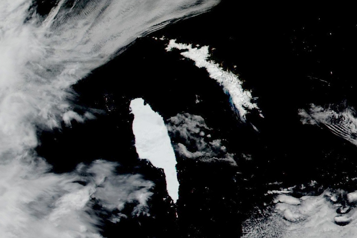
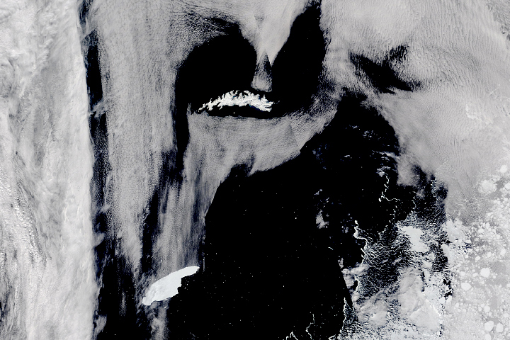
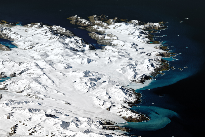
An astronaut aboard the International Space Station took this photo of the remote snow-covered island of South Georgia. The highest point on the island is Mount Paget, which at 2,935 meters (9,629 feet) tall casts a long shadow in the early afternoon sunlight. This mountainous, barren island is 160 kilometers (100 miles) long and has an area slightly larger than Rhode Island. Annenkov Island appears in the lower right.
Numerous glaciers cover South Georgia. They flow down from the ice caps that lie along the mountainous spine of the island, known as the Allardyce Range. The main community, Grytviken, lies on the coast of a well-protected bay. Recent snowfall blankets the glaciers and the rocky terrain that forms the coastlines.
Grytviken was originally a whaling station with a population of 500 people, but the town is no longer permanently inhabited. Tourists on cruise ships visit the town during the Southern Hemisphere’s summer. The remains of the whaling station, a church, and a general store are the only facilities in Grytviken. Sir Ernest Shackleton, a pioneer explorer of Antarctica in the early 1900s, is buried in the Grytviken cemetery. The island’s non-permanent population now consists of scientists with the British Antarctic Survey. They occupy a few buildings in nearby King Edward Point, and their numbers vary from 12 to 44 depending on the season.
South Georgia is the largest of nine islands along a 1,125-kilometer (700-mile) stretch in the southern Atlantic Ocean. The islands, a British overseas territory, are known as the South Georgia and South Sandwich Islands. King Edward Point is the capital of the territory and is the second-smallest capital in the world.
South Georgia has a history of environmental degradation and recovery. The Norwegian or brown rat (Rattus norvegicus) invaded the island, introduced by seal- and whale-hunting boats in the 1800s. Rats preyed on the eggs of several bird species and caused a major reduction in albatross and penguin populations. The South Georgia pipit (Anthus antarcticus) and the South Georgia pintail (Anas georgica georgica), both endemic bird species, nearly became extinct due to the rat predation. However, the brown rat was eliminated by 2015.
Astronaut photograph ISS071-E-581751 was acquired on September 1, 2024, with a Nikon Z 9 digital camera using a focal length of 400 millimeters. It is provided by the ISS Crew Earth Observations Facility and the Earth Science and Remote Sensing Unit, Johnson Space Center. The image was taken by a member of the Expedition 71 crew. The image has been cropped and enhanced to improve contrast, and lens artifacts have been removed. The International Space Station Program supports the laboratory as part of the ISS National Lab to help astronauts take pictures of Earth that will be of the greatest value to scientists and the public, and to make those images freely available on the Internet. Additional images taken by astronauts and cosmonauts can be viewed at the NASA/JSC Gateway to Astronaut Photography of Earth. Caption by Justin Wilkinson, Texas State University, Amentum JETS Contract at NASA-JSC.