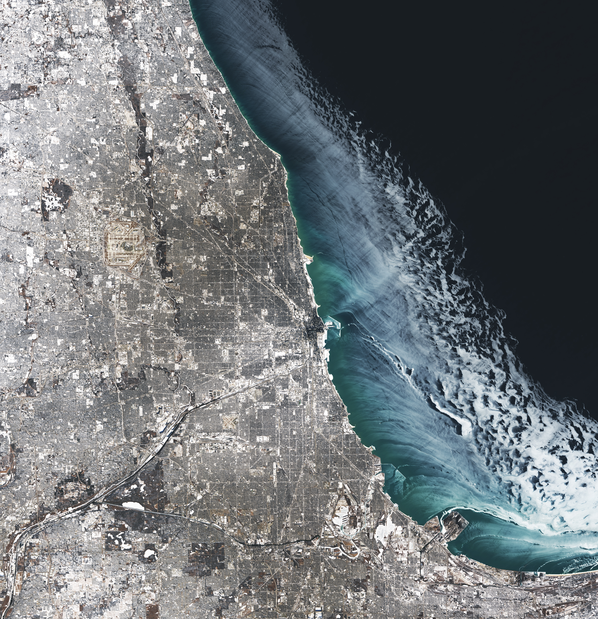
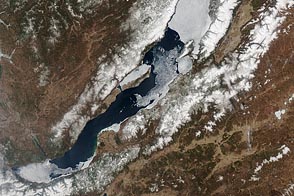
Between January 19 and 24, 2025, a brutal cold snap hit Chicago. This satellite image captured a glimpse of the wintry aftermath.
The first half of the cold spell saw the chilliest weather, according to the National Weather Service (NWS). On January 21, the air temperature in Chicago reached as low as minus 15 degrees Fahrenheit (minus 26 degrees Celsius). At the time, little to no snow covered the ground in Chicago, which NWS noted is uncommon amid sub-zero temperatures.
Snowflakes returned toward the end of the cold spell. Between the mornings of January 22 and 23, several waves of snowfall produced the blanket of white across the Chicago area visible in this image, acquired on January 24, 2025, with the OLI (Operational Land Imager) on Landsat 8.
Another expanse of white is visible atop Lake Michigan. This is lake ice, which grows on the Great Lakes each winter, though its extent and timing can be highly variable. Ice coverage on the Great Lakes typically reaches its annual peak in late February or early March.
On January 24, winds were blowing offshore and pushing ice away from the coastline, according to Jia Wang, an ice climatologist at NOAA’s Great Lakes Environmental Research Laboratory (GLERL). Areas of thin (dark) ice closer to shore transition into patchy areas of bright white ice away from shore. Wang thinks these whiter areas might be due to ice that has piled up and formed a very rough surface.
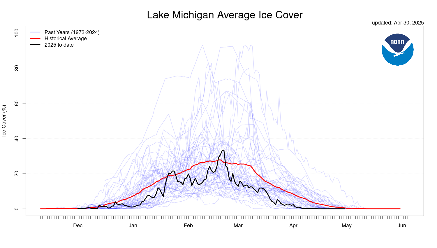
The area of Lake Michigan covered with ice in late January 2025 hovered around the historical average (1973-2024) for the time of year, according to data from GLERL. When the image was acquired, ice covered about 20 percent of the lake.
Meanwhile, several hundred miles to the east, ice on Lake Erie spiked well above average in late January, according to GLERL, with ice spanning around 80 percent of the lake. The ice was thick enough to temporarily immobilize a Canadian cargo freighter, according to news reports.
Scientists are currently investigating ways to use altimetry data from NASA’s ICESat-2 (Ice, Cloud and land Elevation Satellite-2) to determine the thickness of ice on the Great Lakes. According to Eric Anderson, a researcher at the Colorado School of Mines, such measurements could improve ice and weather forecasting as well as help us understand changes in Earth’s surface freshwater.
NASA Earth Observatory image by Michala Garrison, using Landsat data from the U.S. Geological Survey. Story by Kathryn Hansen.


