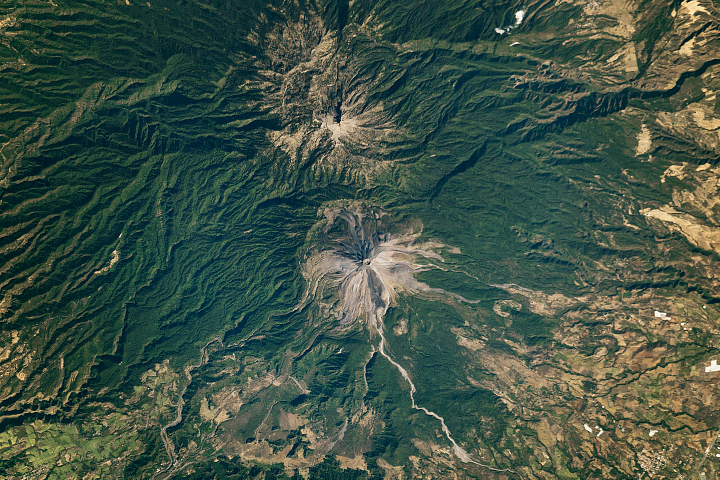
Between 158,000 and 40,000 years ago, at least three explosive eruptions—including the first-documented super-eruption in Central America—reshaped the landscape of southwestern Guatemala. The activity created a huge caldera that filled with water and formed Lago de Atitlán (Lake Atitlán).
The modern-day lake and volcanic landscape are visible in this image, acquired on January 17, 2024, with the OLI (Operational Land Imager) on Landsat 8. The data were draped over a digital elevation model from NASA’s SRTM (Shuttle Radar Topography Mission) to emphasize the terrain.
Since the super-eruption about 85,000 years ago, three “new” volcanoes have formed along the southern side of the caldera rim. Volcán Atitlán is the most active, youngest, and tallest. Its forested slopes are replaced by rocky terrain near the summit, especially on the southern side, deposited there during past eruptions. Explosive eruptions at Atitlán have been documented since the 15th century, with the most recent known event occurring in 1853. Atitlán has been known to release volcanic gases between explosive events.
In contrast, nearby Volcán San Pedro and Volcán Tolimán lie dormant. Past activity at Tolimán, however, has left behind thick, hardened lava flows that form the irregular shape of Lago de Atitlán’s southern shoreline. Elsewhere around the shore, the land is dotted with towns (gray) and agricultural land (light brown). Coffee, corn, beans, wheat, potatoes, sugar cane, and vegetables are commonly grown in the region.
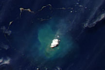
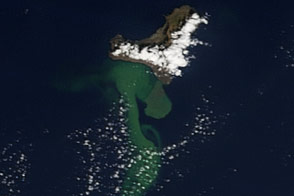
Lago de Atitlán, which plunges to a maximum depth of about 340 meters (1,115 feet), is thought to be the deepest lake in Central America and appears a striking shade of blue. Some areas, however, display a slight tinge of green. This color might be due to sediment washed into the lake carried by the rivers at the lake’s northern side. Some of it might be due to blue-green algae, or cyanobacteria—single-celled organisms that can grow swiftly when nutrients like phosphorus and nitrogen are abundant in still water. Blooms of these cyanobacteria now occur most years, with significant blooms appearing in Lago de Atitlán in October-November 2009 and August 2015.
The Lake Atitlán Forecasting System, however, indicated that the probability of a bloom on the day of this image was about 42 percent. That’s low, according to Africa Flores-Anderson, a research physical scientist at NASA’s Marshall Space Flight Center. Flores-Anderson, who worked with scientists from the University of Alabama in Huntsville, the joint USAID-NASA SERVIR program, and Lake Atitlán’s environmental authority to design the forecasting system, noted that blooms typically occur when probabilities reach 60 percent or higher.
In abundance, cyanobacteria can produce toxins and lead to dead zones. Modern societies may not be the only ones to have grappled with these issues. Researchers found evidence in sediment cores that bloom events may have coincided with ancient Maya settlements around the lake 1,000 years ago.
NASA Earth Observatory image by Wanmei Liang, using Landsat data from the U.S. Geological Survey. Story by Kathryn Hansen.