Some 20,000 years ago, during the Last Glacial Maximum, the Baltic Sea sat under a sheet of ice as thick as 3,000 meters (10,000 feet). Scientists estimate that the weight of that ice pressed the land down more than 500 meters (1,600 feet).
Since the glaciers receded and the weight was lifted, the land has been bouncing back. The rates of uplift, known as glacial isostatic adjustment or isostatic rebound, in this region are among the highest on Earth. By one estimate, 700 hectares of new land—about twice the size of Central Park in New York City—rise from the sea each year along the coast of the Gulf of Bothnia, the Baltic Sea’s northern arm.
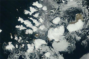
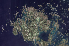
This uplift is especially apparent in the Kvarken Archipelago of Finland. The area, seen in this image acquired by the OLI (Operational Land Imager) on Landsat 8, is an agglomeration of islands that is constantly changing as the land rises. Its approximately 5,600 islands and 2,400 kilometers (1,500 miles) of shoreline form labyrinthine waterways that present hazards to ships but exploration opportunities for canoers and kayakers. The Kvarken Archipelago, along with the High Coast region across the gulf in Sweden, is designated as a UNESCO World Heritage site.
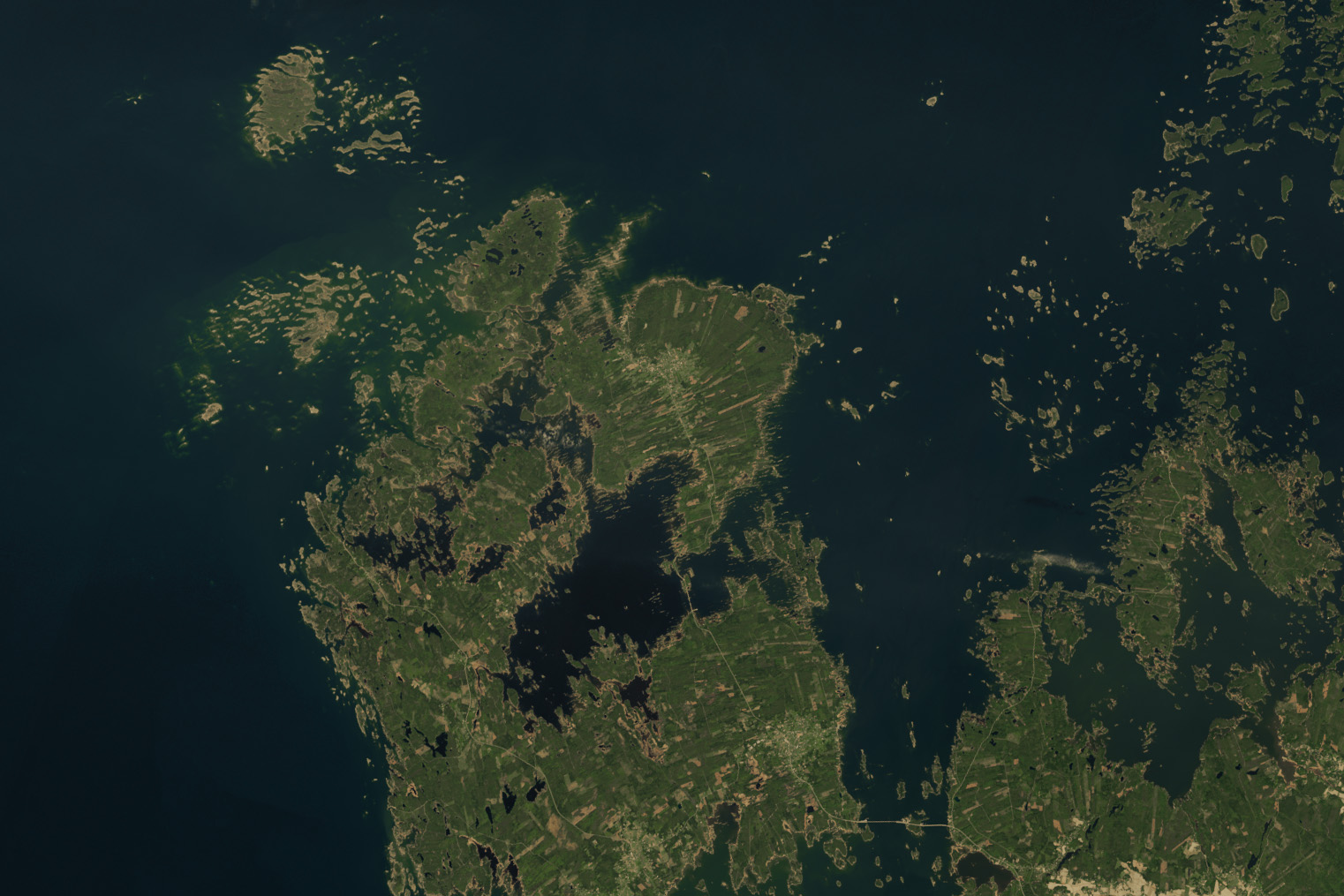
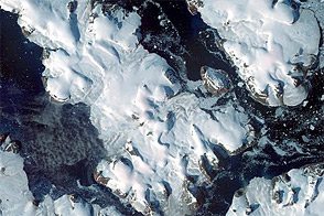
The terrain emerging from the sea has revealed remarkable glacial formations. On and around the island of Björkö, shown in this detailed view, unique features known as De Geer moraines have surfaced thanks to isostatic rebound. These washboard-like ridges form when water running beneath the ice deposits boulders, stones, and finer material at the ice edge. When the ice retreats or a large block breaks away, another moraine begins to form at the new edge.
De Geer moraines typically measure 1 to 2 kilometers long and 2 to 5 meters high, spaced 50 to 200 meters apart. Scientists think their presence and spacing are related to the speed of ice-margin retreat, the water depth in which they were formed, and the terrain beneath the ice. LiDAR-based digital elevation models have recently revealed the existence of more De Geer moraines in southern and western Finland than previously realized.

The constant emergence of new land after the ice’s disappearance affected how people ultimately developed the area. For example, the land on which the town of Vaasa was founded was a forested island in the early 14th century. The island later merged with the mainland, and Vaasa grew throughout the 17th and 18th centuries as a thriving harbor and trading point. Still, the land continued to rise, causing the coastline to migrate farther and farther from the town. In August 1852, a napping peddler’s pipe ignited a fire that destroyed much of the settlement. Officials took the opportunity to reestablish Vaasa about 6 kilometers (4 miles) to the west to make it a coastal city once again. Remnants of the original town are preserved in “Old Vaasa” (or Vanha-Vaasa).
The islands, peninsulas, and coastlines around the Kvarken Archipelago and the Gulf of Bothnia will continue to morph and evolve. Since the ice retreated, the land has risen at least 286 meters (938 feet); this figure corresponds to the elevation of the ancient shore and so-called “world’s highest coastline,” located across the gulf at Skuleberget in Sweden’s High Coast. The remaining 100 meters or so of depression should equilibrate over the next several thousand years, scientists say.
In that time, the sea level will continue to drop relative to the land, and the Gulf of Bothnia will continue to narrow. Millennia from now, the shores of Finland and Sweden may even connect at the narrowest point, rendering the northern Gulf of Bothnia an inland lake. However, the exact nature of these changes will depend on how much global sea level rise—driven by ice melt and thermal expansion of ocean water—offsets the regional land uplift. Currently, the rate of regional uplift, at about 9 millimeters (0.4 inches) per year, outpaces the 3.4 millimeters (0.13 inches) of global sea level rise per year.
NASA Earth Observatory images by Wanmei Liang, using Landsat data from the U.S. Geological Survey. Photo by Hendrik Morkel, Unsplash. Story by Lindsey Doermann.