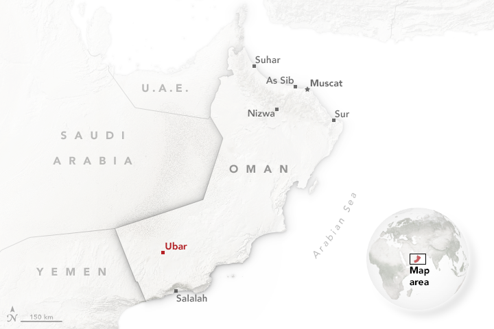

Oman’s second largest city—Salalah—lies in a coastal plain hemmed in by the lush Qara mountains. Though the country is generally dry, this part of southern Oman gets a few months of foggy, rainy weather in July and August due to the arrival of a monsoon, which is known locally as khareef.
On October 15, 2016, the Advanced Spaceborne Thermal Emission and Reflection Radiometer (ASTER) sensor on NASA’s Terra satellite captured this image of the city. Streams carved a network of channels in the highlands surrounding the city; those highlands have long offered fertile ground for stands of frankincense trees (Boswellia Sacra) and other vegetation. Dried frankincense resin—prized in ancient times as much as gold for its use as incense, religious ceremonies, and funeral rituals—once put this area at the center of global trading routes that connected southern Oman with the rest of the Arabian Peninsula, the Middle East, India, and Asia.
In the 10th century B.C.E., archaeologists think that the biblical Queen of Sheba reigned over this busy coastal trading region from the nearby city of Sumharam (to the east). Spices, textiles, and silk would arrive by ship from India and China, and they would be sent back out with frankincense and myrrh. On land, camel caravans would carry goods north to Egypt, Persia, Palmyra, and Rome.

In the 1990s, a team of explorers and archaeologists discovered several new sites in southern Oman and Yemen by examining satellite imagery for faint tracks in the desert, presumably left by ancient caravans. It is thought that the settlements—including the famed lost city of Ubar, roughly 75 kilometers (45 miles) north of Salalah—played key roles in the frankincense trade.
Read more about the search for Ubar in our feature Peering through the Sands of Time: Searching for the Origins of Space Archaeology.
NASA Earth Observatory image by Jesse Allen, using data from NASA/GSFC/METI/ERSDAC/JAROS, and U.S./Japan ASTER Science Team. Story by Adam Voiland.