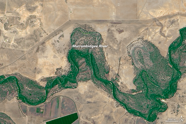


The Murray-Darling basin of southeast Australia has been called the country’s food bowl. The basin spans four states and covers more than 1 million square kilometers between the country’s two longest rivers (the Murray and the Darling). Extensive irrigation has allowed farmers here to produce and raise a large fraction of Australia’s domestic supply of produce and livestock.
More than half of the basin falls within the state of New South Wales. These images, acquired on January 10, 2013, by the Advanced Land Imager (ALI) on the Earth Observing-1 (EO-1) satellite, show a stretch of agricultural land in southwestern New South Wales. January is a busy harvest time in the region, when crops such as wine grapes are harvested. Farmers grow everything from cotton, cereal grains, fruits, nuts, and vegetables to the feed for the region’s livestock.
Circles and squares of farmland in the top image contrast sharply with the surrounding dry landscape. Farmers here rely on the diversion of water from rivers, as opposed to rainfall, to supply the water for farming. Click on the large image to see the farmland in context with the nearby river systems. The second image, centered 27 kilometers south of the top image, shows the Murrumbidgee River—a major tributary of the Murray.
According to the Murray-Darling Basin Authority, the advance and retreat of glaciers between 100,000 and 10,000 years ago helped shape the basin’s dunes, alluvial plains, and rivers by carrying vast amounts of water to the area. But today, even with 20 significant rivers flowing across the basin, irrigators face the challenge of drought. According to news reports, water flows in 2015 were as low as in 2002-2003, when the so-called “millennium drought” first took hold—one of the worst droughts on record for southeast Australia.
NASA Earth Observatory image by Joshua Stevens and Jesse Allen, using EO-1 ALI data provided courtesy of the NASA EO-1 team. Caption by Kathryn Hansen.