

Crete is the largest and most populous Greek island, spanning 8,300 square kilometers (3,200 square miles) and supporting a population of 620,000. A short distance northwest of Crete is a lesser-known Greek island, Antikythera. The island is comparatively tiny, spanning just 20 square kilometers (8 square miles) and supporting a human population that hovers around 50.
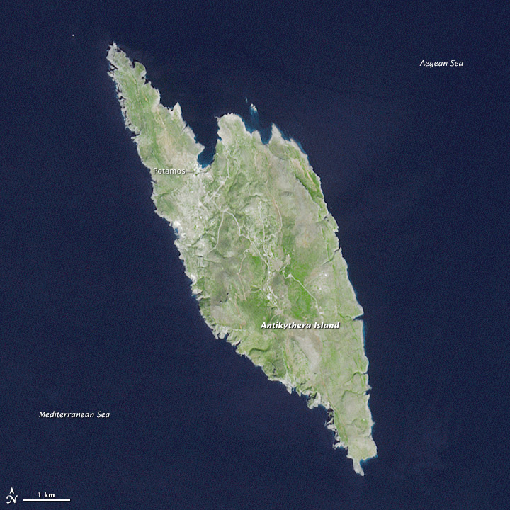
This view of Antikythera was acquired on September 23, 2013, by the Advanced Spaceborne Thermal Emission and Reflection Radiometer (ASTER) on the Terra satellite. The landscape is typical of a small Mediterranean island, consisting primarily of open countryside and low shrubs. Steep, limestone cliffs line most of the island; flatter expanses of beach are more common on Kythira, a larger Greek island to the north.
Antikythera’s port town of Potamos is visible on the island’s north side. A network of paved roads connects a small number of villages and infrastructure, including a helipad. Roads come to an end, however, before reaching the lighthouse—faintly visible on the island’s southern end.
The lighthouse, built in 1926, is not the only reminder of this small island’s long history. The remnants of more than 12,000 agricultural walls and terraces, likely constructed in the 19th century, still litter the landscape. Achaeological evidence suggests that the oldest settlement on the island was established long before that, sometime between 4000-3000 B.C.E.
The area’s history even extends below the water line. In 1900, divers offshore in the Aegean Sea discovered a 2,000-year-old shipwreck. Artifacts included the famed Antikythera mechanism—a geared device sometimes referred to as the world’s first computer. In 2014 and 2015, the Woods Hole Oceanographic Institution led a scientific expedition to further study the wreck.
NASA Earth Observatory image by Jesse Allen, using data from NASA/GSFC/METI/ERSDAC/JAROS, and U.S./Japan ASTER Science Team. Caption by Kathryn Hansen.