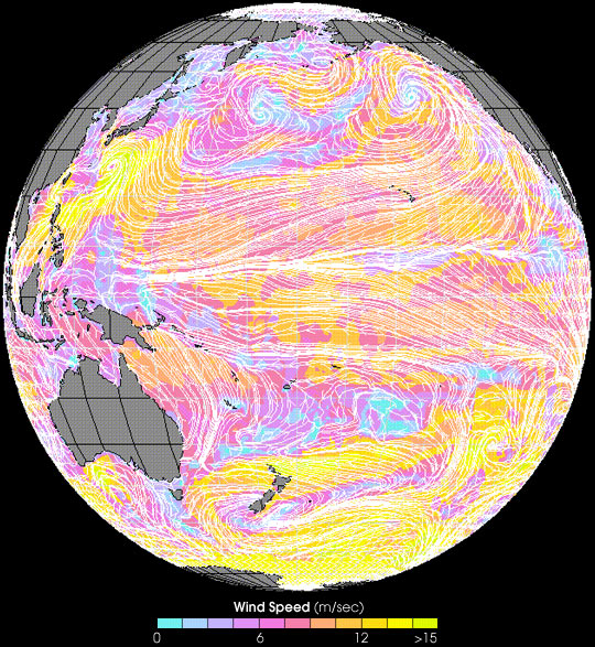


In early July 2000, a series of typhoons hit Japan and the Philippines, killing over a dozen people. Typhoon Kirogi scored a direct hit on Tokyo, bringing up to 10 inches of rain in the area.
This image from the SeaWinds satellite shows the typhoon on July 7, 2000. Color indicates wind speed (blue represents low wind speed, yellow high) and white arrows indicate wind direction. Japan is in the upper left-hand corner of the image. Also note the Intertropical Convergence Zone, the band of winds blowing from east to west across the equatorial Pacific.
For current images from SeaWinds, visit the Seaflux web site.
Image from the NASA/NOAA sponsored data system Seaflux, at JPL through the courtesy of W. Timothy Liu and Wenqing Tang.