

The Advanced Spaceborne Thermal Emission and Reflection radiometer, ASTER, is an international project: the instrument was supplied by Japan's Ministry of International Trade and Industry. A joint US/Japan science team developed algorithms for science data products, and is validating instrument performance. With its 14 spectral bands, extremely high spatial resolution, and 15 meter along-track stereo capability, ASTER is the zoom lens of the Terra satellite. The primary mission goals are to characterize the Earth's surface; and to monitor dynamic events and processes that influence habitability at human scales.
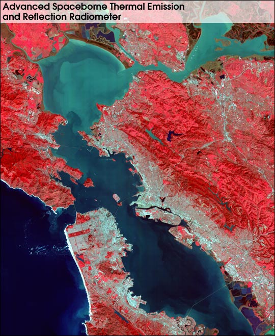
ASTER's monitoring and mapping capabilities are illustrated by this series of images of the San Francisco area. The visible and near infrared image reveals suspended sediment in the bays, vegetation health, and details of the urban environment.
Flying over San Francisco, we see the downtown, and shadows of the large buildings. Past the Golden Gate Bridge and Alcatraz Island, we cross San Pablo Bay and enter Suisun Bay. Turning south, we fly over the Berkeley and Oakland Hills. Large salt evaporation ponds come into view at the south end of San Francisco Bay. We turn northward, and approach San Francisco Airport. Rather than landing and ending our flight, we see this is as only the beginning of a 6 year mission to better understand the habitability of the world on which we live.
For more information: ASTER Web Site
Image courtesy of MITI, ERSDAC, JAROS, and the U.S./Japan ASTER Science Team