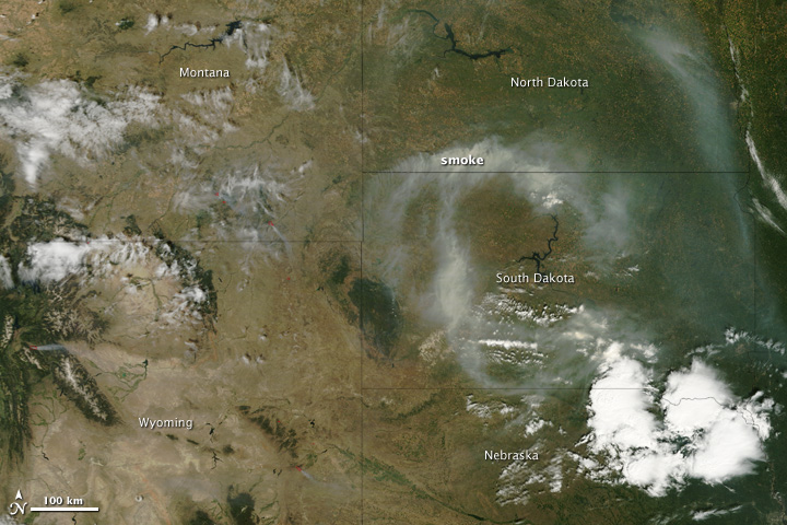


Late summer fires filled the skies over the Upper Midwest with smoke on August 23, 2011. Ignited by lightning, the fires are clustered in southern Montana and Wyoming. The Moderate Resolution Imaging Spectroradiometer (MODIS) on the Terra satellite acquired this image on the morning of August 23. The top version of the image provides a wide view of the smoke, while the lower version is a closer view of one of the fires in Wyoming.
In both images, fire is marked in red. Some of the fires currently burning are hidden beneath cloud, but a cluster of fires are visible in southeastern Montana and in western Wyoming in the top image.
The lower image shows the Red Rock Fire burning in the Gros Ventre Wilderness southeast of Grand Teton National Park. Lightning started the fire on August 20, and it is being managed to maintain public safety while allowing the fire to burn. The fire is burning in conifer forest that contains many dead or weakened trees from a bug infestation. Fire is the natural way to replace the old forest with young trees. At 6,218 acres as of August 25, the Red Rock Fire is relatively small compared to some of the other blazes in the region. However, it is the smokiest fire visible in this image.
NASA image courtesy the MODIS Rapid Response Team at NASA GSFC. Caption by Holli Riebeek.