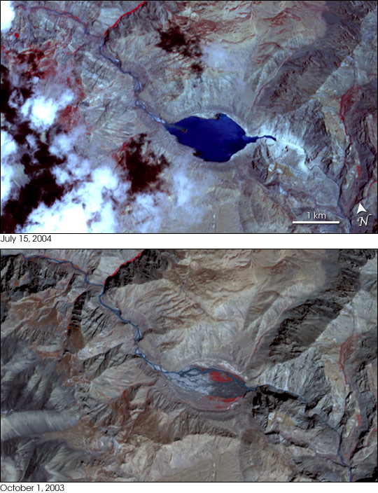


Rock and mud piled over a river in Tibet could spell disaster for communities 35 kilometers downstream in northern India. In early summer, a landslide in the Zaskar Mountains, a range of the Himalayas, blocked the Pareechu River in its course from the Tibet Autonomous Region of China to the Himachal Pradesh State of northern India. The water is slowly building behind the natural dam, creating an artificial lake in the remote mountain region. By August 13, the lake had spread over 188 hectares and had reached a depth of 35 meters, with water levels rising daily. Indian and Chinese officials fear that the unstable dam will burst, releasing a torrent of water on populated regions of northern India. The remoteness of the region and the ruggedness of the terrain have precluded preventative measures that the Chinese government might otherwise undertake to control the release of the water.
The top image shows the growing lake on July 15, 2004. What had been a river valley around the meandering Pareechu River on October 1, 2003, has been entirely covered with dark blue water. Both images were acquired by the Advanced Spaceborne Thermal Emission and Reflection Radiometer, (ASTER) on NASA’s Terra satellite, and show the lake at 15 meters per pixel.
NASA images courtesy courtesy NASA/GSFC/MITI/ERSDAC/JAROS, and U.S./Japan ASTER Science Team