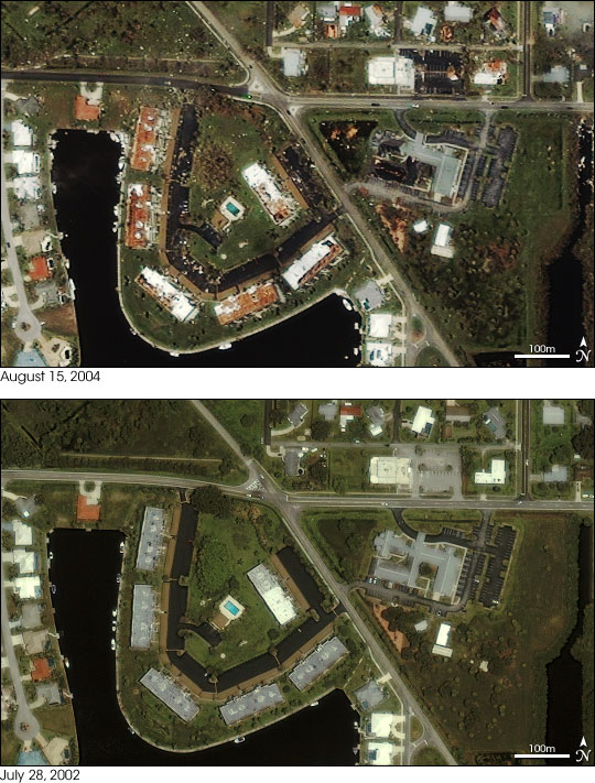


Hurricane Charley blew ashore over Punta Gorda, Florida, on August 13, 2004, with winds topping 145 miles per hour. Two days later, the Ikonos satellite captured this stunning image as it orbited 423 miles above the Earth. The top image shows the destruction the Category 4 hurricane wrought on the coastal city. Debris is scattered across roads, parking lots, and yards, giving the scene a “messy” appearance compared to the crisp, neat neighborhoods shown in the lower image, taken on July 28, 2002. Half of the large grey building, just right of center, seems to be missing, and the buildings to its left have lost their roofs. Above the turquoise rectangular swimming pool in the center of the scene, the decorative oval landscaping that was readily apparent in 2002 has been replaced by a brown circle, possibly the result of trees being blown over. The full scene gives a quick, broad view of the city at a resolution of one meter per pixel. These and the images of neighboring Charlotte Harbor, provided in the links above, can be used for disaster assessment, search and recovery operations, and by the insurance industry.
For images of Hurricane Charley, please visit the Severe Storms section of the Earth Observatory.
Image copyright DigitalGlobe.