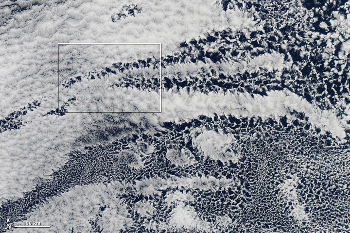


Looking up from the ground or a boat, we can pick out distinctive cloud shapes, even decide which pets or farm animals clouds might resemble. But satellites, which observe clouds from above and view thousands of square kilometers at once, can detect complex cloud patterns that aren’t obvious on a human scale. As satellite observations have accumulated, our understanding of cloud forms has grown. Among the interesting cloud patterns visible at the satellite scale are open- and closed-cell stratocumulus clouds.
On April 17, 2010, the Moderate Resolution Imaging Spectroradiometer (MODIS) on NASA’s Aqua satellite captured a natural-color image of a network of clouds over the Pacific Ocean off the coast of Peru. The top image shows a wide-area view of the region, and the bottom image shows a close-up view of the area outlined in white in the top image.
The clouds in this image occur in “cells” that resemble compartments in a honeycomb. Open-cell clouds look like empty compartments, whereas closed cells look like compartments stuffed with cloud. A study published in 2005 found that, despite their moisture-free appearance, pockets of open cells are actually associated with the development of precipitation. Uninterrupted decks of closed-cell stratocumulus clouds produce little to no drizzle; pockets of open cells occur as drizzle begins to fall.
For more information on these cloud formations, see the Earth Observatory feature Cloudy with a Chance of Drizzle.
NASA image by Jeff Schmaltz, MODIS Rapid Response Team at NASA GSFC. Caption by Michon Scott.