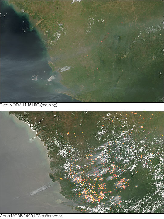


Over the course of the day on April 4, 2004, scores of fires sprang up across the West African country of Sierra Leone. In the morning, when the Moderate Resolution Imaging Spectroradiometer (MODIS) on the Terra satellite captured the top image of this pair, few active fires were burning. By afternoon, when the MODIS sensor on the Aqua satellite captured the bottom image, scores of actively burning fires (marked in yellow) were spread across the country.
The widespread nature of the fires and the season suggests that these fires are being set intentionally for agricultural purposes. Though not necessarily hazardous, such large-scale burning can have a strong impact on weather, climate, human health, and natural resources.
Image courtesy Jeff Schmaltz, MODIS Rapid Response Team, NASA-GSFC