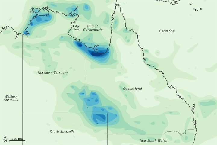


In late February and early March 2010, a monsoon low-pressure system moved from Australia’s Northern Territory into Queensland. ABC News Australia reported that the monsoon system drenched areas that usually experience little precipitation. The town of Birsdville, Queensland (located east of Northern Territory and immediately north of the Queensland-South Australia border), recorded its heaviest rainfall in a century on March 1, 2010. The monsoon system combined forces with another weather system off Australia’s southeast coast, raising fears of flooding throughout Queensland.
This color-coded image shows estimated rainfall amounts from February 24 to March 2, 2010. Lowest rainfall amounts (less than 50 millimeters) appear in pale green, and heaviest amounts (more than 450 millimeters) appear in dark blue. The heaviest amounts appear along the fairly sparsely populated coastline of the Gulf of Carpentaria. Relatively heavy amounts also appear inland, near the Queensland-South Australia border, in the region of Birdsville.
This image is based on data from the Multisatellite Precipitation Analysis produced at Goddard Space Flight Center, which estimates rainfall by combining measurements from many satellites and calibrating them using rainfall measurements from the Tropical Rainfall Measuring Mission (TRMM) satellite.
NASA image by Jesse Allen, using near-real-time data provided courtesy of TRMM Science Data and Information System at Goddard Space Flight Center. Caption by Michon Scott.