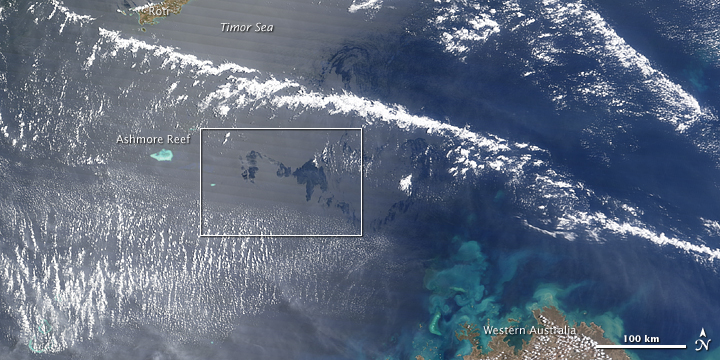


What was probably a sheen of oil calmed the waters of the Timor Sea and darkened the mirror-like reflection of the Sun when the Moderate Resolution Imaging Spectroradiometer on NASA’s Terra satellite captured this image on September 17, 2009. The top image shows the wider area, with part of Western Australia at lower right. The colorful water near the shore is probably a mixture of sediment and phytoplankton. The bottom image is a close up of the area outlined in white.
The oil was leaking from a well that was damaged during drilling on August 21. According to news reports, chemicals that help the oil disperse are being dropped on the slick from airplanes. The light-colored streaks may be some combination of oil and dispersant.
Twice-daily images of the Timor Sea are available from the MODIS Rapid Response Team Website. Note that the slick will not be visible in every image; viewing conditions have to be perfect for a thin sheen of oil or droplets to be visible in photo-like satellite imagery. (See a previous image in this event for an explanation.)
NASA image created by Jesse Allen, using data obtained from the Goddard Land Processes data archives (LAADS). Caption by Rebecca Lindsey.