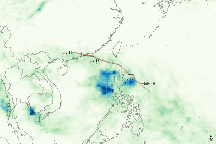


Typhoon Molave tracked across the western Pacific Ocean between July 16 and July 19, 2009, dropping heavy rain in its path. The area of heaviest rain, shown in dark blue, is around the Philippine Islands. Molave caused extensive flooding in the northern Philippines. The heaviest rain is also concentrated south of the center of the storm. A photo-like image of the storm shows that Molave was not symmetrical. More clouds gathered on the south side of the eye, corresponding to the rainfall pattern shown here.
The image was based on data from the Tropical Rainfall Measuring Mission (TRMM) satellite, which carries a unique space-based precipitation radar. The detailed measurements from TRMM’s precipitation radar are used to calibrate less detailed measurements from other satellites in the Multisatellite Precipitation Analysis, a near-real-time rainfall estimate produced by scientists at NASA’s Goddard Space Flight Center. This image shows rainfall totals over the western Pacific Ocean as recorded by the Multisatellite Precipitation Analysis between July 16 and July 19, 2009.
NASA image by Jesse Allen, using near-real-time data provided courtesy of the TRMM Science Data and Information System at Goddard Space Flight Center. Caption by Holli Riebeek.