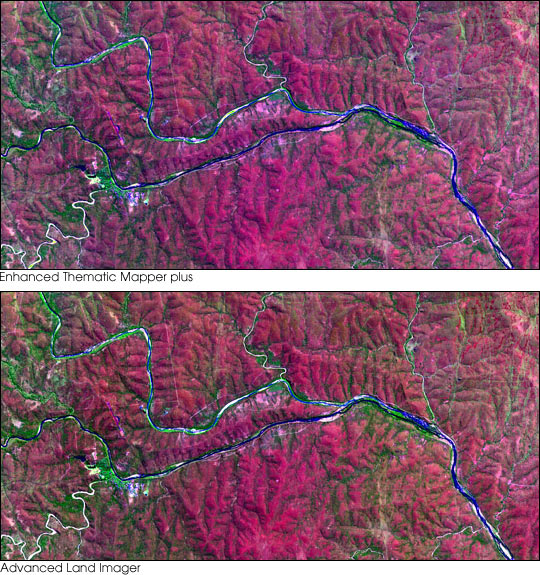


This pair of images shows the same area of South Africa’s Kruger National Park taken by different satellite sensors only minutes apart. The top image is from the Enhanced Thematic Mapper plus (ETM+) aboard Landsat 7, the latest in a long line of high-resolution remote sensing satellites begun in 1972 with the Earth Resources Technology Satellite (ERTS), later renamed Landsat-1. The bottom image was acquired by the Advanced Land Imager (ALI) aboard Earth Observer-1 (EO-1), an instrument designed to test new technologies that will continue the observations begun by the Landsat satellites. Future instruments like the ALI will be much smaller and less expensive than the ETM+, enabling NASA and the United States Geological Survey (USGS) to continue exploring the surface of the Earth.
Both images above are false color composites combining short wave infrared (1.65 µm), near infrared (.79 µm), and green (.57 µm) wavelengths as red, green, and blue, respectively. Dense vegetation appears green. The similarity of the images demonstrates the ability of the ALI to produce data that can be compared with the 29-year archive of Landsat data. Several NASA field campaigns conducted in Kruger National Park provided ground-based data needed to evaluate measurements from each of the satellite sensors.
For more information, read the EO-1 fact sheet and the Landsat-7 fact sheet.
Images courtesy Landsat 7 Science Team