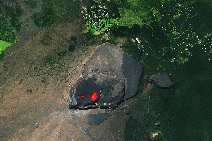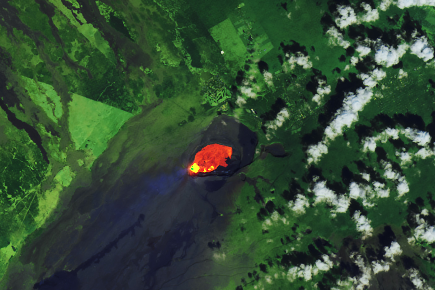
On December 23, 2024, after three months of quiet, Kīlauea began spewing fountains of lava. The lava poured from a line of fissures near the southwest wall of Halema'uma'u crater, which lies within Kaluapele—the Hawaiian volcano’s summit caldera. The ongoing eruption is the sixth to occur within this caldera since 2020.
The U.S. Geological Survey (USGS) Hawaiian Volcano Observatory saw eruptive activity begin at 2:20 a.m. local time on December 23. That morning, USGS observed fountains of lava reaching up to 80 meters (262 feet) high. By 9:30 a.m., a Hawaiian Volcano Observatory helicopter measured new lava spread across 650 acres (265 hectares) of the crater floor, with an average depth of about 10 feet (3 meters).
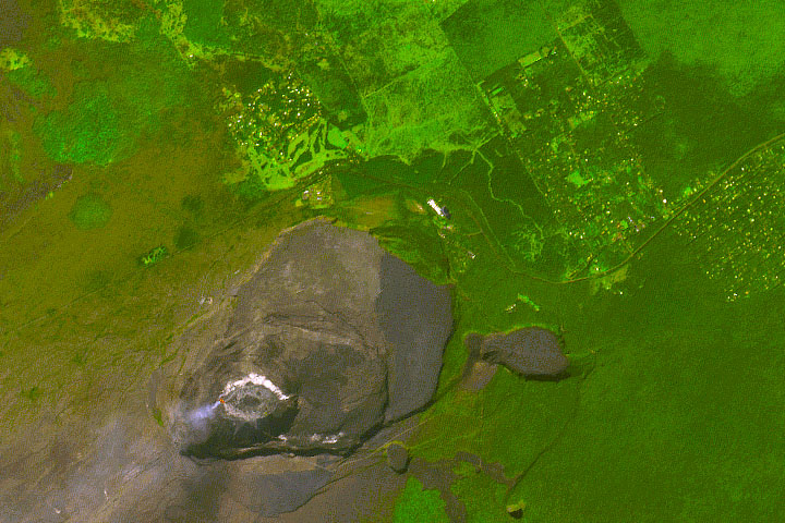
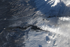
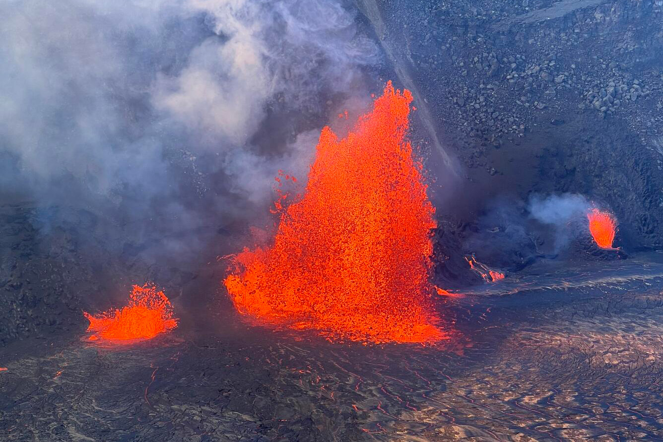
The OLI (Operational Land Imager) on Landsat 8 captured this image of Kīlauea’s caldera on December 24. The image is false color (bands 7, 6, and 8) to highlight the infrared signature of the new lava (red and yellow). That same day, USGS took the photograph below of lava erupting within Kaluapele.
Volcanic gas—primarily water vapor, carbon dioxide, and sulfur dioxide—wafts southwest of the caldera in the image (in blue). Volcanic gas was the primary concern for this eruption because it can have far-reaching effects. Sulfur dioxide released from the summit during an eruption can create an unhealthy haze known as volcanic smog (vog) that can drift downwind.
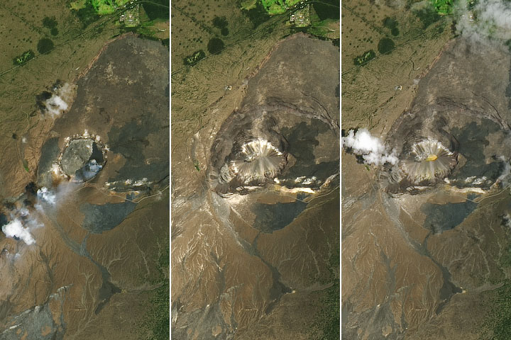
Kīlauea is Hawaii’s youngest and most active volcano. Prior to the December 2024 event, it displayed activity in September 2024, when USGS observed multiple eruptions east of Kīlauea’s caldera, in a well-known magma storage region in the east rift zone.
According to USGS, eruptions in the summit region have lasted for about a week to more than a year. This eruption, like most others, started with vigorous lava and volcanic gas emission, but as of December 30, the intensity of lava flow had diminished.
NASA Earth Observatory image by Wanmei Liang, using Landsat data from the U.S. Geological Survey. USGS photo by H. Winslow. Story by Emily Cassidy.