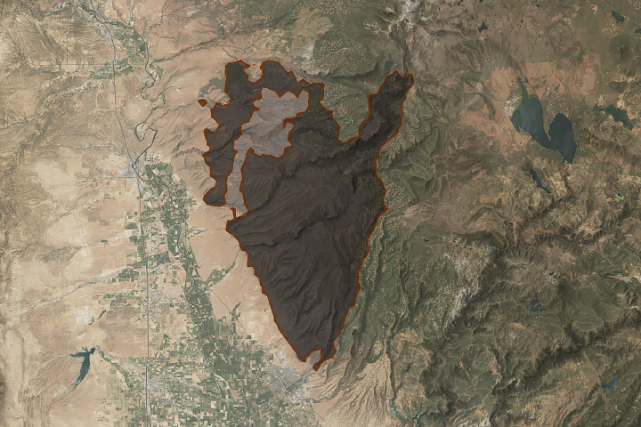
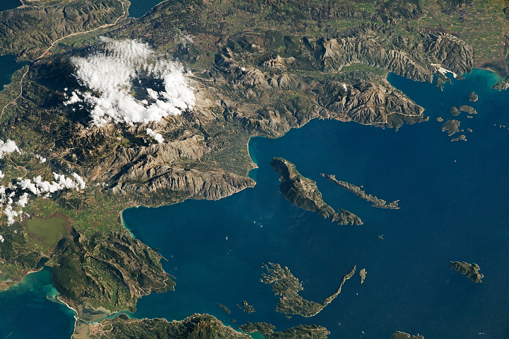
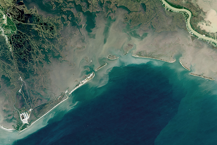
An astronaut aboard the International Space Station photographed towns along Italy’s Tyrrhenian Sea coastline. The image presents a mixture of hues ranging from light-colored waters of the Gulf of Policastro, an inlet of the Tyrrhenian Sea, to darker tones of the mountainous terrain of southwestern Italy.
The landscape of central and southern Italy is rugged due to the Apennines, a mountain range that extends down the country’s spine from central Italy to the coastline near the Gulf of Policastro. The proximity of the coastline and mountains results in a vast range of land elevations, from sea level near the coast to over 6,500 feet (2,000 meters) at the top of Monte Sirino.
Seasonal snow highlights the high-elevation mountaintops. The largest region of snow-covered peaks is within the Valle del Fiume Argentino nature reserve, a protected area within the broader Pollino National Park that extends east of this image.
Several large rivers, including the Noce and Lao rivers, flow through the region. The rivers carry rain, spring meltwater, and sediment from the Apennines toward the Gulf of Policastro. Sediment deposited into the shallow waters of the Tyrrhenian Sea creates the opaque white tones swirling in the water near the coast.
Several towns, including Sapri, Scalea, and Praia a Mare, cluster along the coastline and the foothills of the southern Apennines. The orange clay roofs, characteristic of the coastal towns, contrast with the green vegetation and the blue hues of the water. Sandy beaches, which appear as smooth zones along the coastline, attract tourists to the coastal towns.
Astronaut photograph ISS070-E-94260 was acquired on February 14, 2024, with a Nikon D5 digital camera using a focal length of 170 millimeters. It is provided by the ISS Crew Earth Observations Facility and the Earth Science and Remote Sensing Unit, Johnson Space Center. The image was taken by a member of the Expedition 70 crew. The image has been cropped and enhanced to improve contrast, and lens artifacts have been removed. The International Space Station Program supports the laboratory as part of the ISS National Lab to help astronauts take pictures of Earth that will be of the greatest value to scientists and the public, and to make those images freely available on the Internet. Additional images taken by astronauts and cosmonauts can be viewed at the NASA/JSC Gateway to Astronaut Photography of Earth. Caption by Cadan Cummings, Jacobs, JETS II Contract at NASA-JSC.