
In late August 2024, Typhoon Shanshan barreled into Japan. The potent storm had already spurred landslides, power outages, and flooding in the southern parts of the country as it continued to move northeast over the archipelago.
On August 27, before Shanshan made landfall, bands of heavy rain triggered a deadly landslide that buried a house in the city of Gamagori, near Tokyo. The Japan Meteorological Agency (JMA) issued emergency warnings for most of Kyushu Island and parts of central Japan, advising millions of residents to evacuate the area.
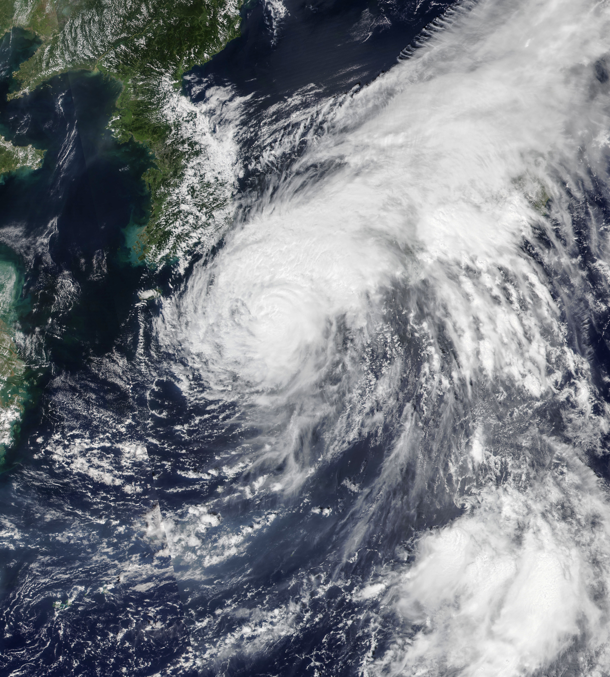
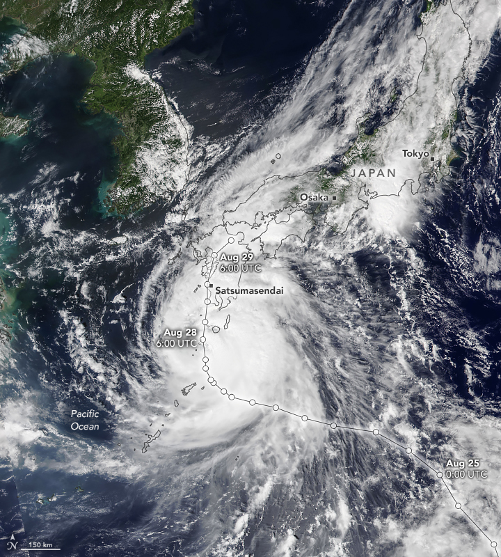
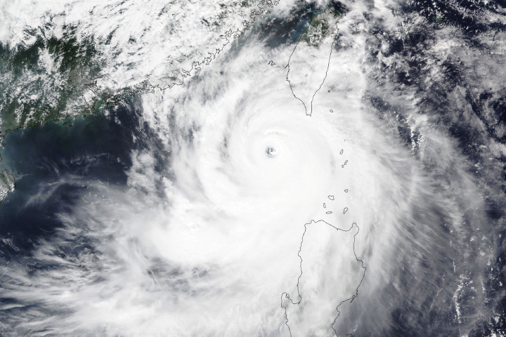
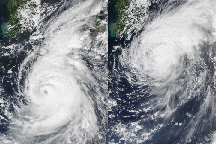
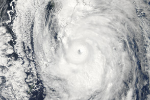
This image (left) shows the typhoon as it approached the main islands of the archipelago on August 28, with sustained winds of about 185 kilometers (115 miles) per hour, the equivalent of a Category 3 hurricane. On the morning of August 29, Shanshan made landfall over the southern tip of Japan’s Kyushu Island, according to the JMA. Winds had weakened to 135 kilometers (85 miles) per hour—equivalent to a Category 1 hurricane—as the storm barreled inland.
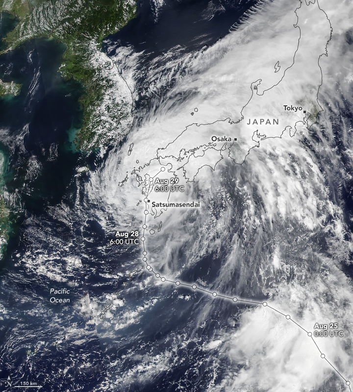
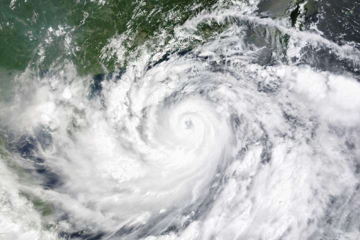
The other image (right) shows Shanshan about five hours after making landfall as it moved over Kyushu. Both images were acquired with the VIIRS (Visible Infrared Imaging Radiometer Suite) on the NOAA-20 satellite.
High waves hit the southern coast of the island, and hurricane-force winds knocked over trees and powerlines. More than 100,000 households were without power the evening of August 29, according to a local power distribution company.
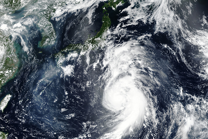
The slow-moving storm continued to drench southern Japan as it moved northeast. As of August 29, parts of Miyazaki and Kagoshima prefectures reported rainfall accumulations topping 400 millimeters (15.75 inches) in 24 hours. Since August 26, the city of Ebino in the Miyazaki prefecture has been deluged with over 840 millimeters (33 inches) of rain.
According to University of Tokyo climate scientist Hisashi Nakamura, the typhoon intensified between August 25 and 27, fueled by unusually warm water in the Philippine Sea. During that time, sea surface temperatures were around 30 degrees Celsius (86 degrees Fahrenheit).
The storm was forecast to weaken as it approached Japan's central and eastern regions, including Osaka and Kyoto, on August 31 and September 1.
NASA Earth Observatory images by Michala Garrison, using VIIRS data from NASA EOSDIS LANCE, GIBS/Worldview, and the Joint Polar Satellite System (JPSS). Storm track data from Weather Underground. Story by Emily Cassidy.


