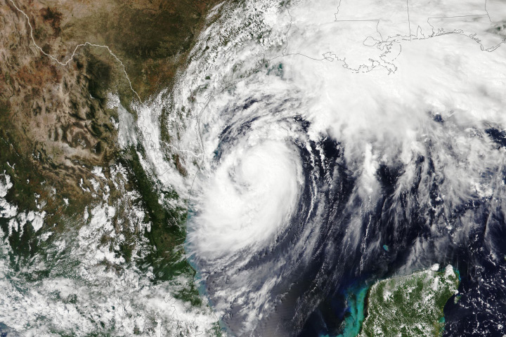
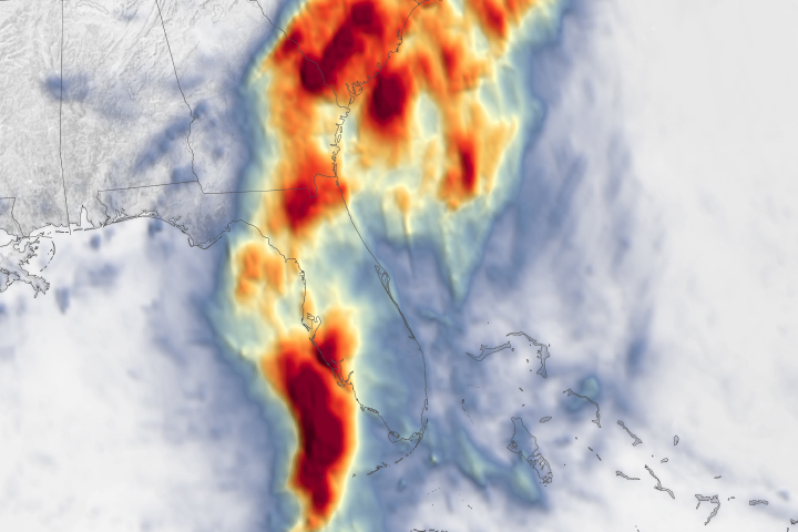
After tearing through the Caribbean and the Yucatan Peninsula, Hurricane Beryl swept ashore over the Gulf Coast of Texas on July 8, 2024. The Category 1 storm had sustained winds of up to 80 miles (129 kilometers) per hour at landfall and brought high gusts and heavy rain to the Houston area.
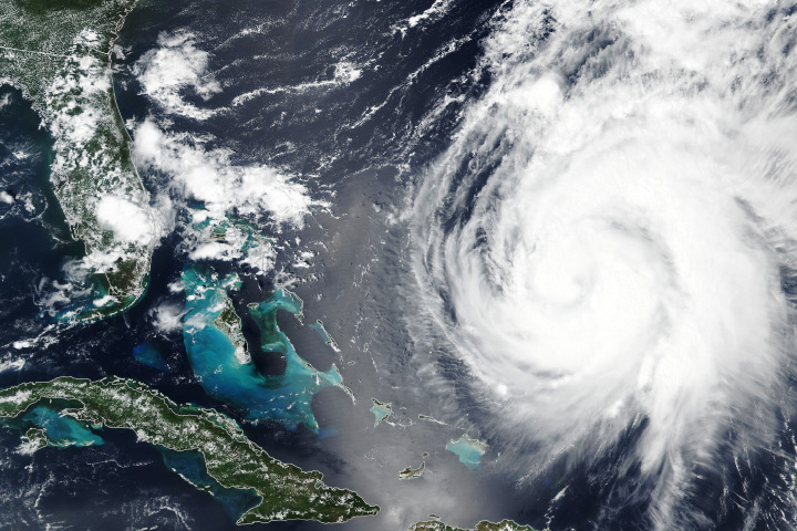
This image shows Beryl at 7:43 a.m. Central Daylight Time (12:43 Universal Time) on July 8, about 3 hours after making landfall near Matagorda, Texas. As it moved north toward Houston, Beryl dumped 6 to 8 inches (15 to 20 centimeters) of rain over the metro area. Local authorities reported flooding along roads, downed trees, and power outages.
This GeoColor image (above) was captured by the ABI (Advanced Baseline Imager) on the GOES-16 (Geostationary Operational Environmental Satellite-16). GeoColor images show natural color reflectance during the daytime and multi-spectral infrared bands at night. The satellite is operated by the National Oceanic and Atmospheric Administration (NOAA), which includes the National Weather Service. NASA helps develop and launch the GOES series of satellites, which observe Earth from about 22,000 miles (36,000 kilometers) above the equator.

Beryl formed in the Atlantic Ocean on June 28 before explosively intensifying into a major hurricane. Rapid intensification occurs when wind speeds increase by at least 35 miles (56 kilometers) per hour within 24 hours. Between the afternoon of June 29 and the morning of June 30, Beryl’s winds increased by 65 miles per hour to become an “extremely dangerous” Category 4 hurricane.
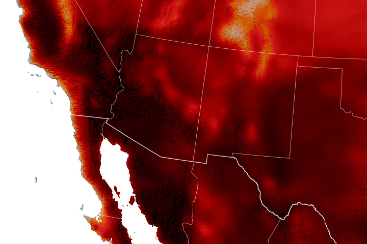
This explosive strengthening was fueled, in part, by warm ocean temperatures. Across the Northern Hemisphere, ocean temperatures for the January-April period averaged 2.12 degrees Fahrenheit (1.18 degrees Celsius) above normal, according to NOAA. Despite the waning El Niño, temperatures at the sea surface and at deeper depths are still above average in many places, according to Josh Willis, an oceanographer at NASA’s Jet Propulsion Laboratory.
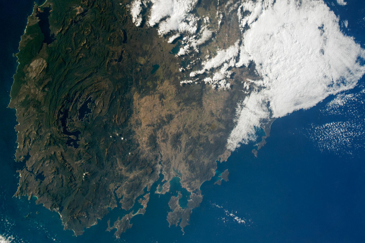
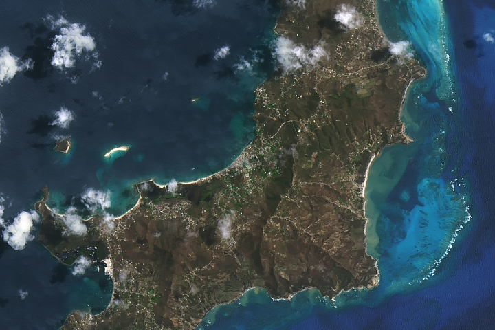
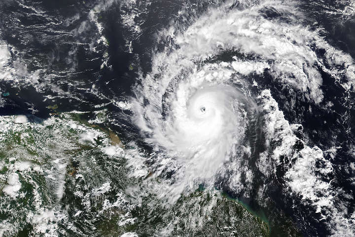
After making landfall on Carriacou Island in the Caribbean on July 1, Beryl continued to strengthen. On July 2, the storm became the earliest Category 5 hurricane observed in the Atlantic basin in NOAA’s record. An astronaut aboard the International Space Station took the photo above on July 2, as Beryl churned through the Caribbean Sea.
Beryl was downgraded to a tropical storm a few hours after making landfall on July 8, but as of noon local time in eastern Texas, hazardous winds and flooding rain continued to batter the region. Over 2.6 million people were without power in the state, according to PowerOutage.us.
NASA Earth Observatory image by Wanmei Liang, using GOES 16 imagery courtesy of NOAA and the National Environmental Satellite, Data, and Information Service (NESDIS). Astronaut photograph ISS071-E-255422 was acquired on July 2, 2024, with a Nikon D4 digital camera using an 65 millimeter lens and is provided by the ISS Crew Earth Observations Facility and the Earth Science and Remote Sensing Unit, Johnson Space Center. The image was taken by a member of the Expedition 71 crew. The image has been cropped and enhanced to improve contrast, and lens artifacts have been removed. The International Space Station Program supports the laboratory as part of the ISS National Lab to help astronauts take pictures of Earth that will be of the greatest value to scientists and the public, and to make those images freely available on the Internet. Additional images taken by astronauts and cosmonauts can be viewed at the NASA/JSC Gateway to Astronaut Photography of Earth. Story by Emily Cassidy.