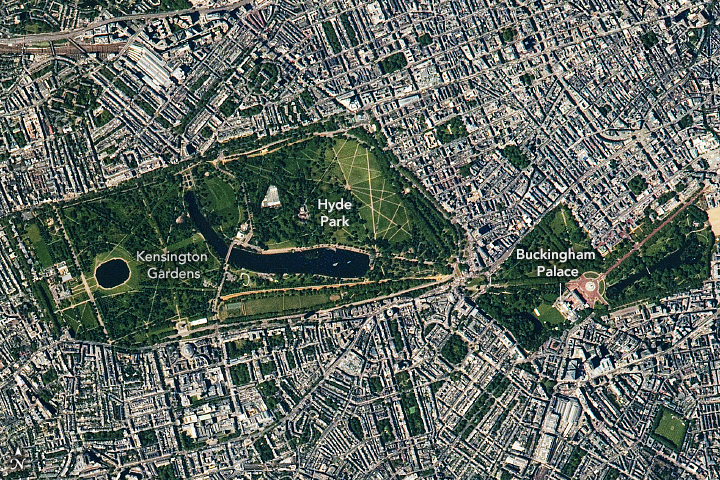


This expansive view of the River Thames flowing eastward through the London metropolitan area is a mosaic of 29 overlapping photographs taken by an astronaut looking down from the International Space Station (ISS). A detailed view of London at this scale is seldom achieved from the ISS due to frequently cloudy conditions.
Recorded history along the Thames dates back to around 50 CE, when the Roman Empire invaded the region and established the settlement of Londinium on the north bank of the river. Londinium became the core financial area as the location was ideal for trade. Invasions, plagues, and fire have since shaped this area over the past several centuries.
The Greater London area is comprised of 32 boroughs, most of which are visible in this photo on both sides of the river. The original city of London continues to be the epicenter of finance and business. Westminster is the center of politics and governance, a borough that includes the Houses of Parliament, the Prime Minister’s residence at 10 Downing Street, and Buckingham Palace.
Sections of the Thames have different historical and cultural significance. One of the most notable is the difference between the east and west ends. Since the river flows east toward the North Sea, most of the shipping and heavy industrial districts developed downstream in the East End where the river is deeper. The West End contains more open spaces with parks and royal palaces.
Bridges are prevalent along the Thames, clustered near London and Westminster. The first “London Bridge” was built by the Romans, and many more were added to the landscape over time. Major landmarks in the mosaic include Wembley Stadium, Hampstead Heath, Regent’s Park, Hyde Park, London Stadium (the 2012 Olympic venue), The O2, Greenwich Park, and the London City Airport.
Astronaut photographs ISS065-E-95234 through ISS065-E-95272 were acquired on June 9, 2021, with a Nikon D5 digital camera using a focal length of 1150 millimeters. They are provided by the ISS Crew Earth Observations Facility and the Earth Science and Remote Sensing Unit, Johnson Space Center. The images were taken by a member of the Expedition 65 crew. The images have been cropped and enhanced to improve contrast, and lens artifacts have been removed. The International Space Station Program supports the laboratory as part of the ISS National Lab to help astronauts take pictures of Earth that will be of the greatest value to scientists and the public, and to make those images freely available on the Internet. Additional images taken by astronauts and cosmonauts can be viewed at the NASA/JSC Gateway to Astronaut Photography of Earth. Caption by Laura Phoebus, Jacobs, JETS Contract at NASA-JSC.