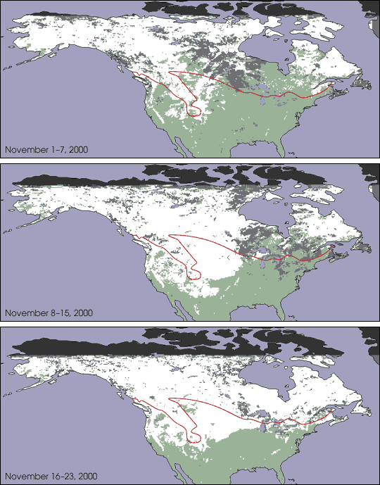


These Moderate-resolution Imaging Spectroradiometer (MODIS) false-color images show the total area in North America covered by snow (white pixels) as compared to the 35-year average snowline (red line). Each image represents an 8-day composite for the periods November 1-7, 8-18, and 16-23, 2001. The light gray pixels show areas that were covered by clouds for the entire 8-day period. The green pixels are land regions without snow, blue pixels represent water, and dark gray shows where no data were collected.
Full press release & large images.
Images courtesy Jim Foster, Janet Chien, George Riggs and Nick DiGirolamo, NASA GSFC